The Permitting Company can provide site plans and maps to existing operators of permitted waste sites who are looking to change their site layout/infrastructure, or to operators who are looking to apply for a permit, and only require site plans and maps as a standalone service.
Our site plans and maps are to scale and UK grid reference specific for ultimate accuracy.
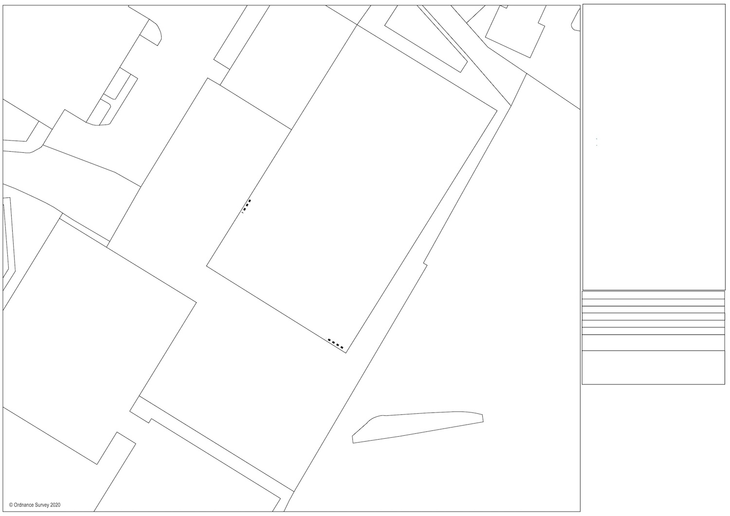
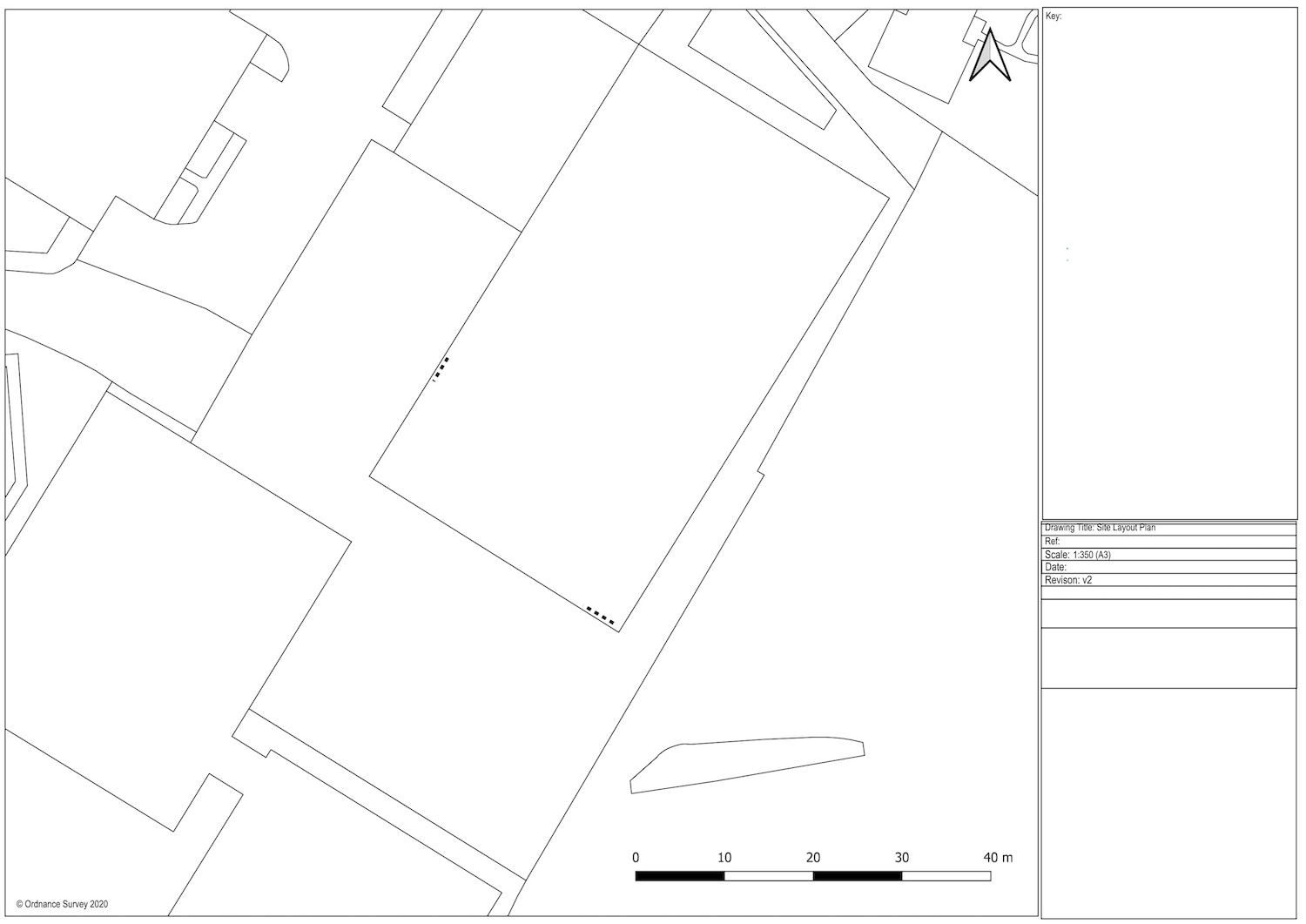
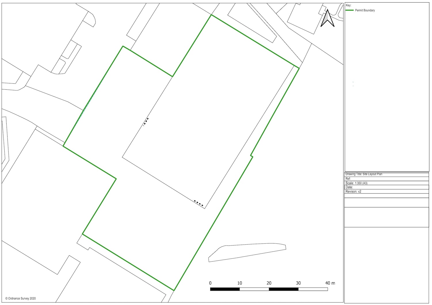
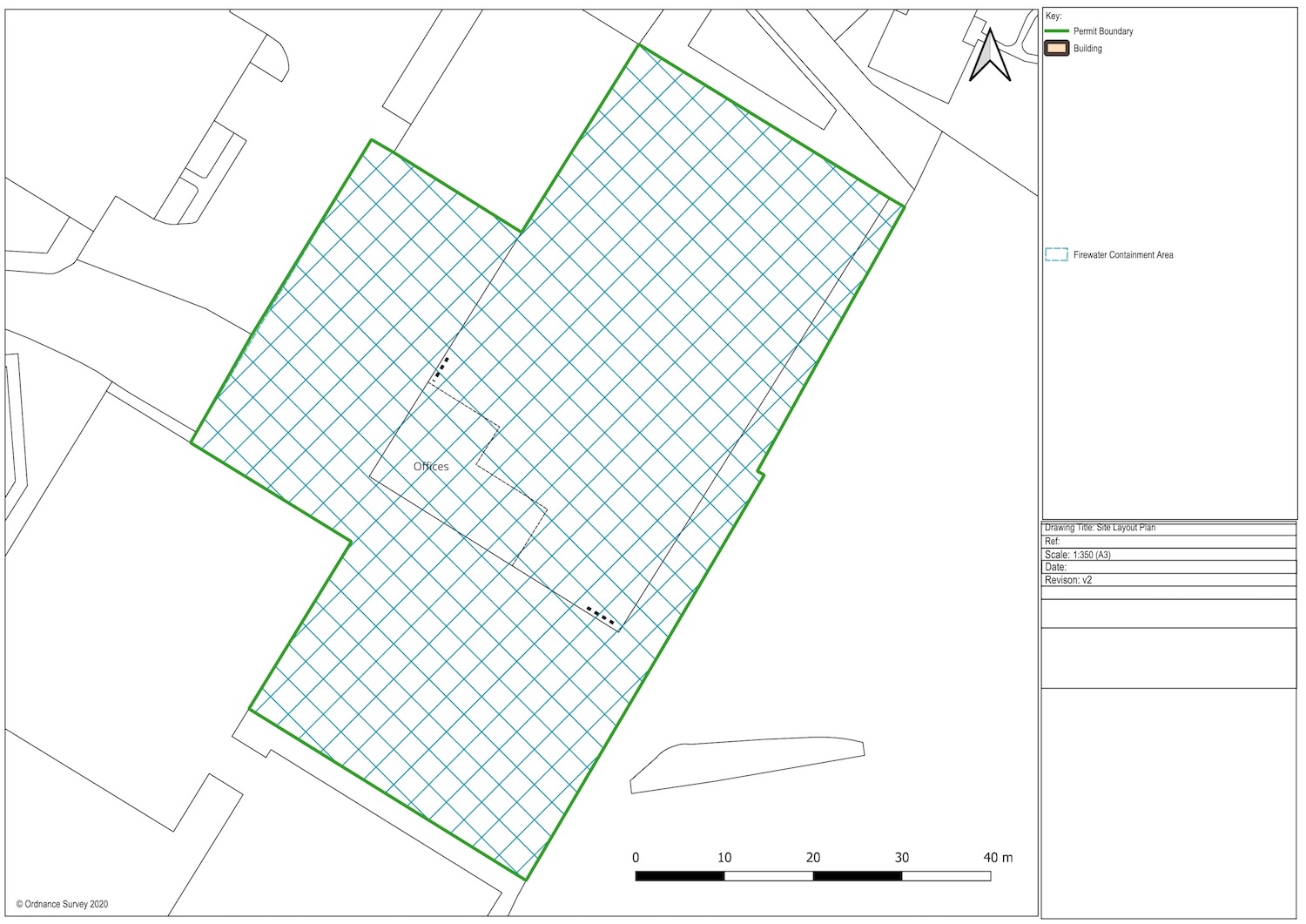
Site Location Plan
A site location is exactly what it sounds like, it shows the location of the site within the surrounding area. More importantly, it will show the permitted area of the waste operation.
This is usually a green boundary and is used by the Environment Agency to check distances from the site to sensitive receptors, but also to regulate your site within this boundary to ensure your operation is not being conducted outside of this area. Site location are required when applying for a permit application, but it can also be required if you are varying a permit to increase the permit boundary e.g. if you require more operational space due to expansions in your waste activity.
There are also instances where a new location plan is required if the existing boundary is not accurate and the regulator requests that the boundary be changed (although this is quite rare).
")
The Permitting Company Limited offer site location plans as a standalone service (or in combination with other plans and maps if required).
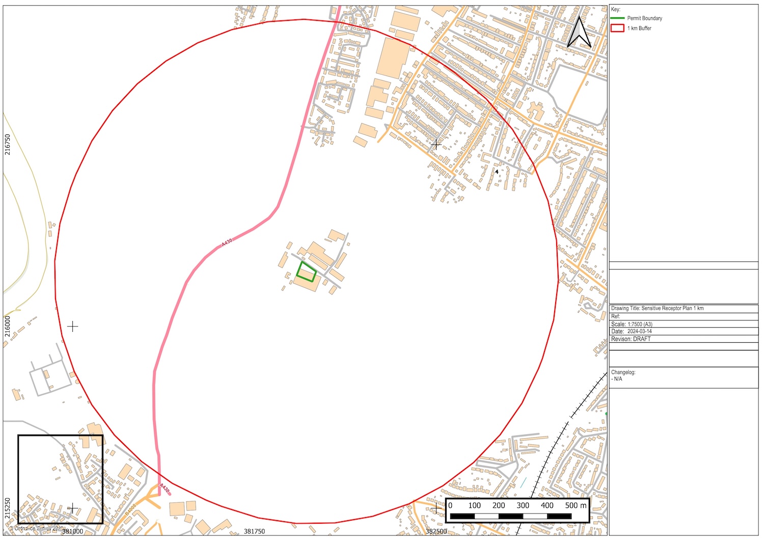
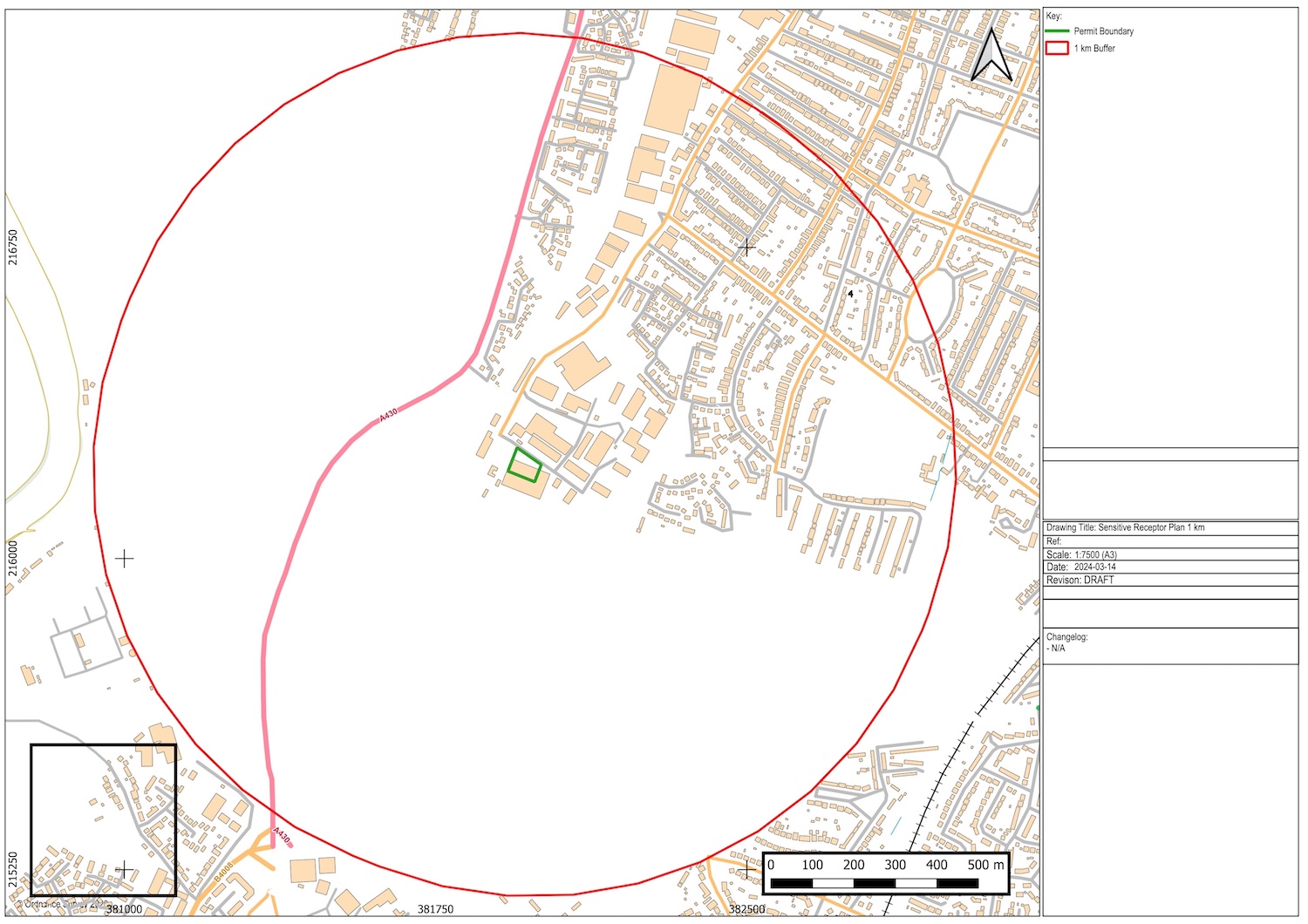
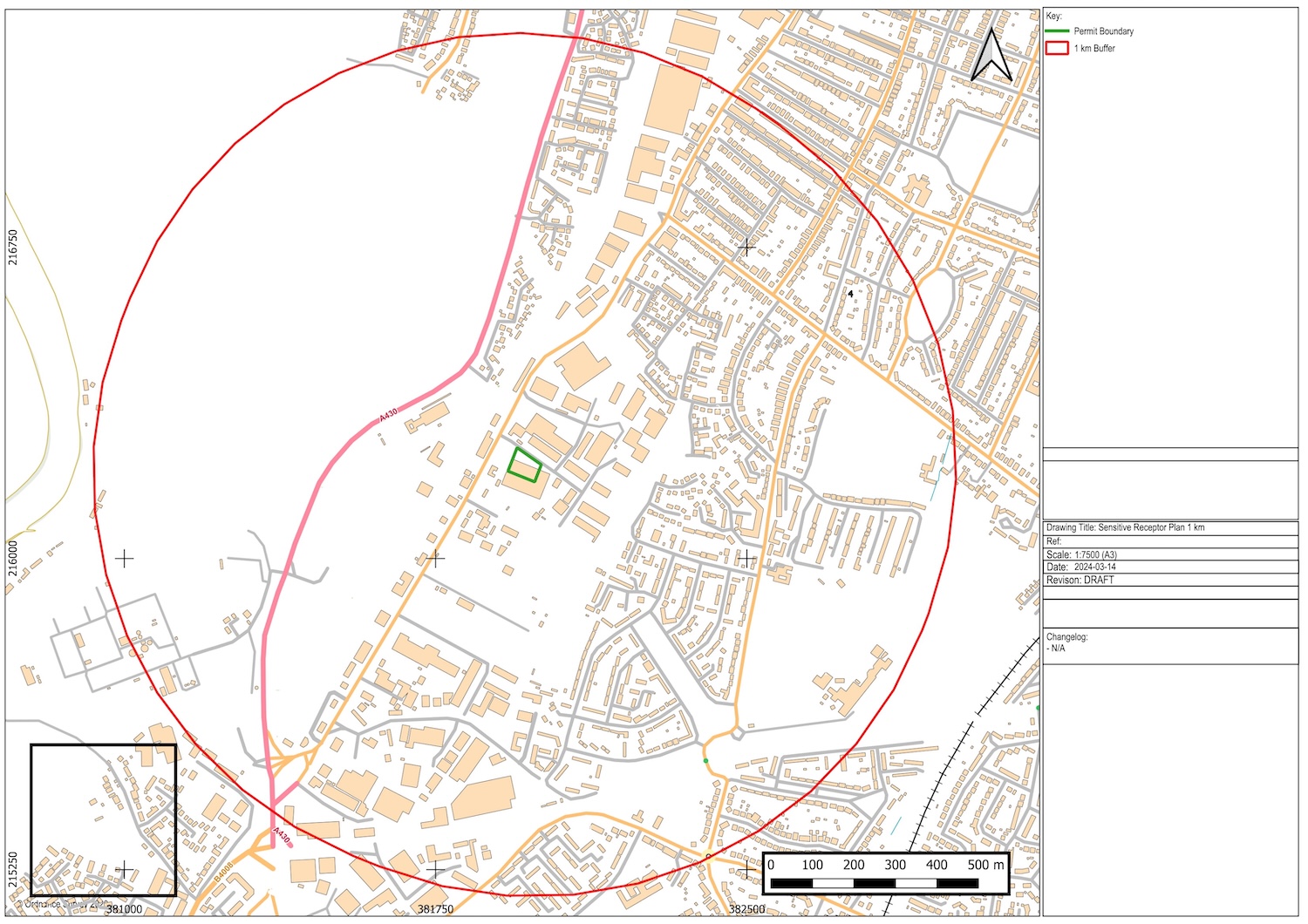
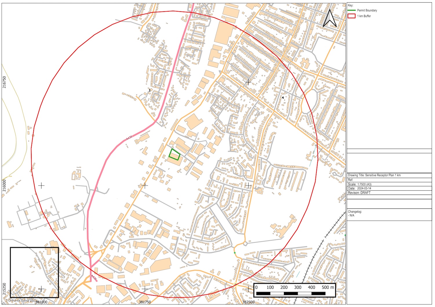
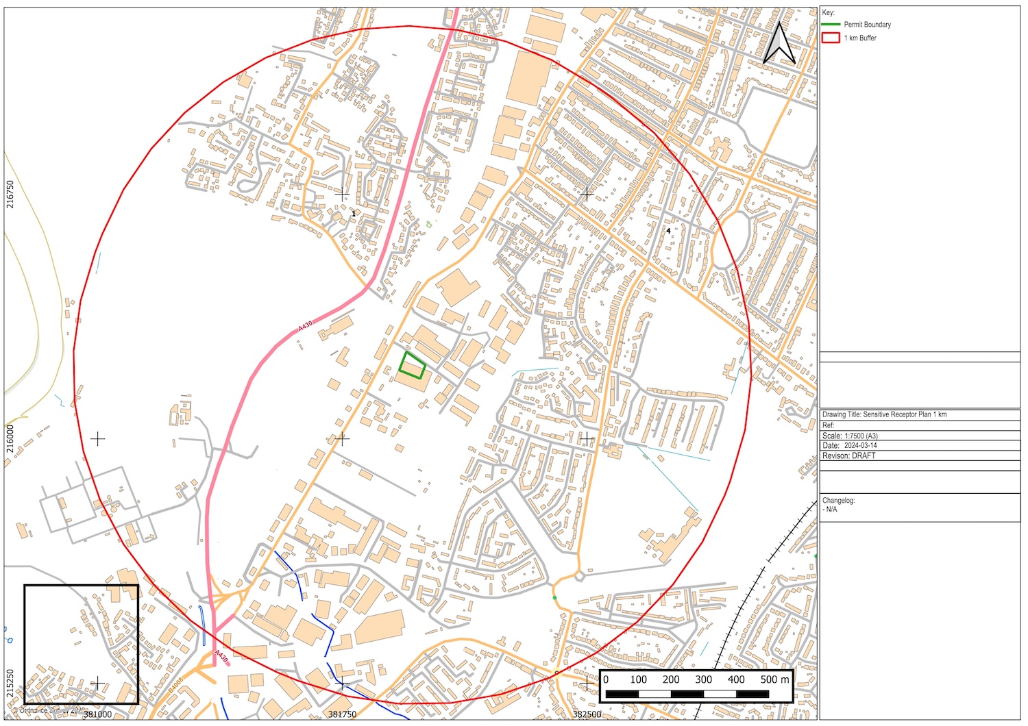
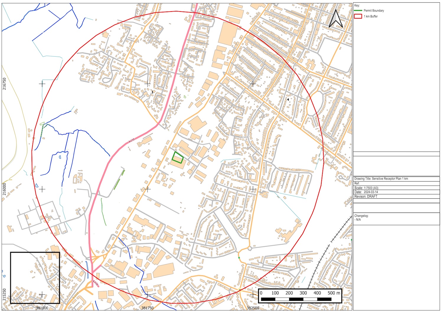
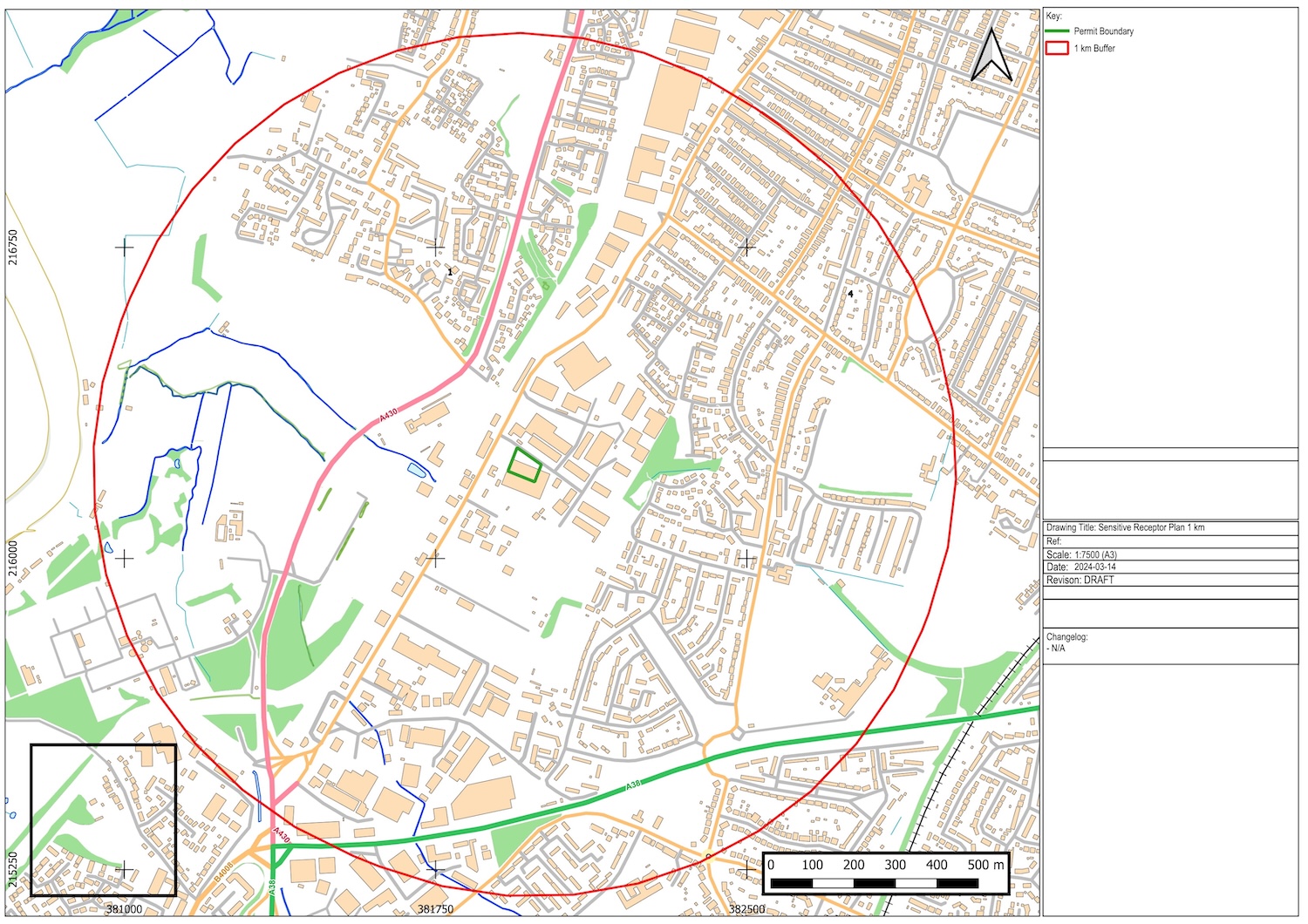
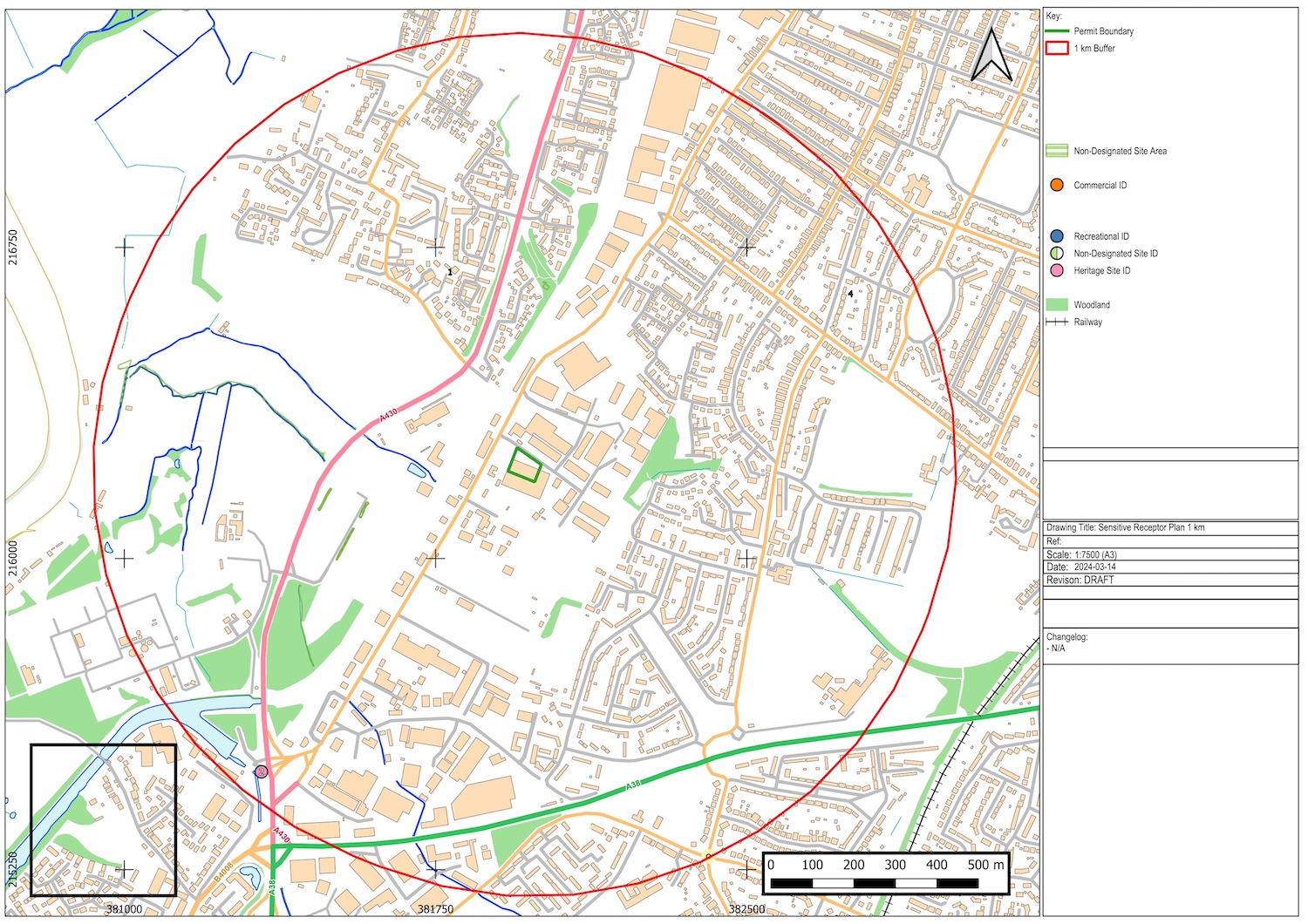
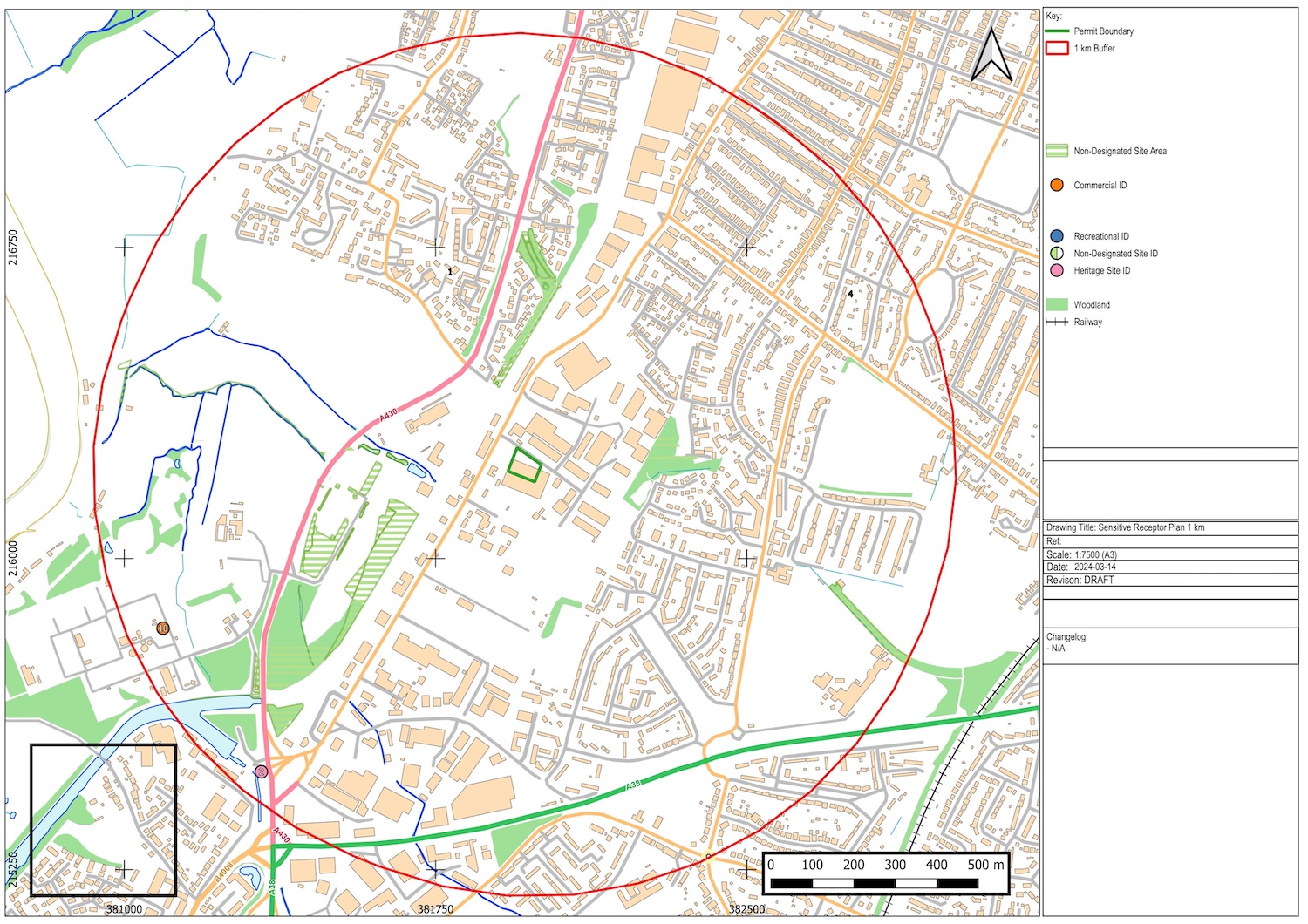
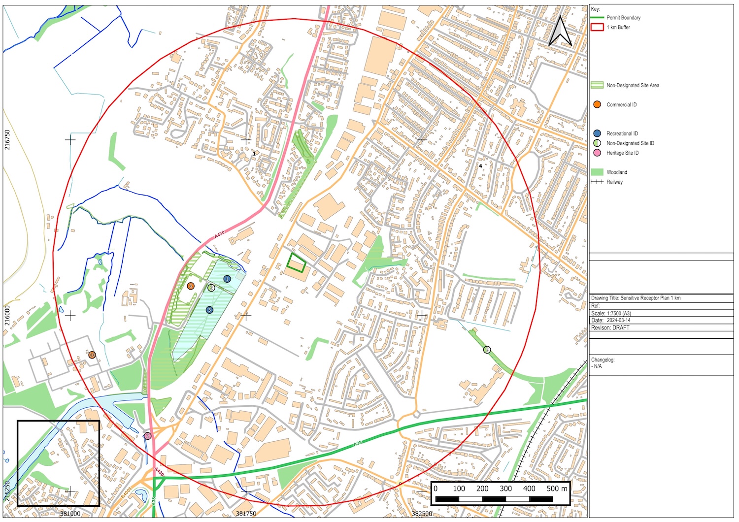
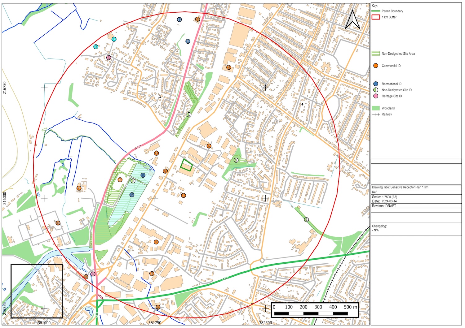
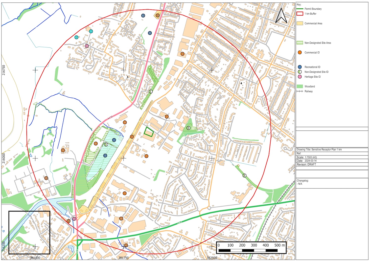
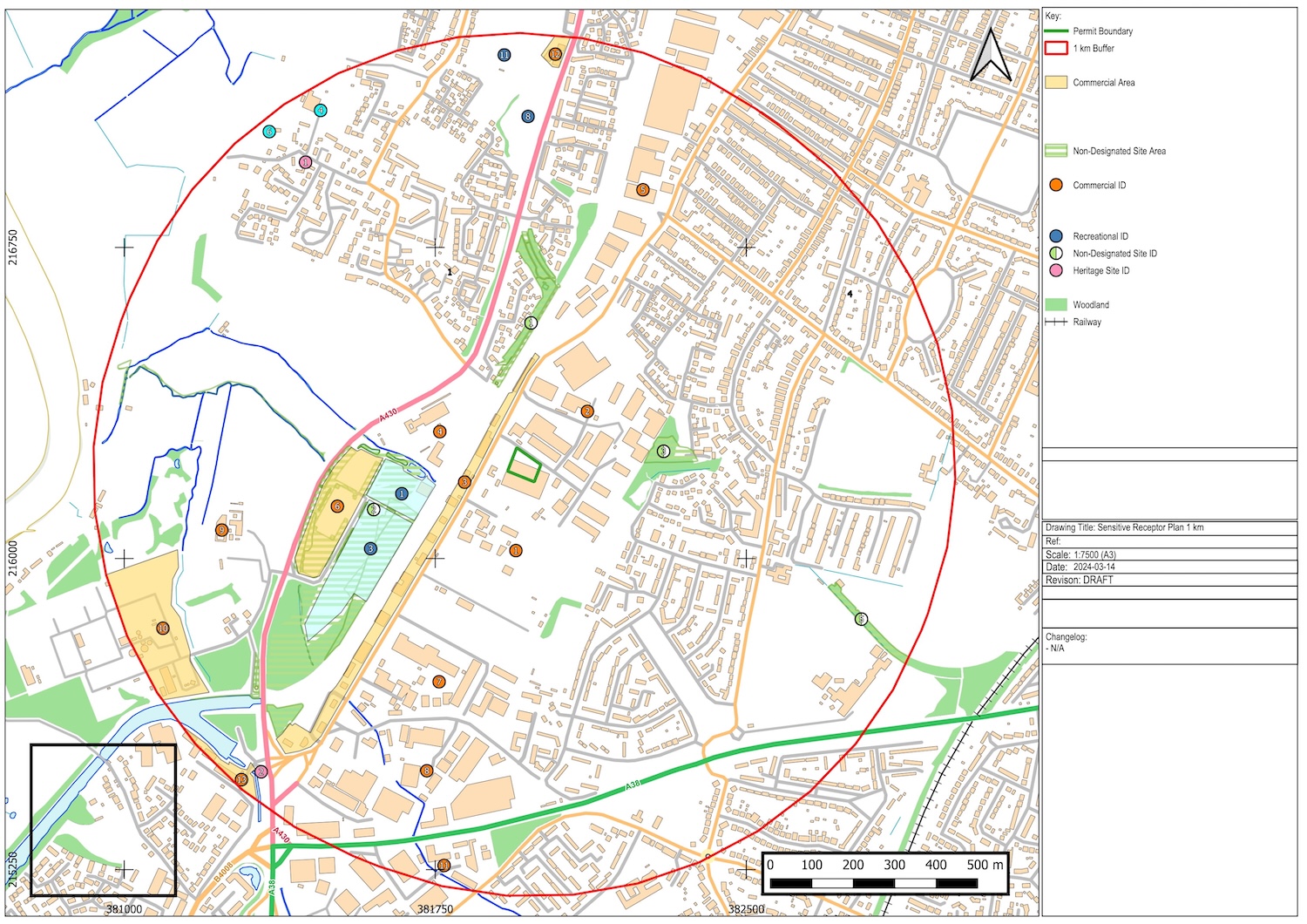
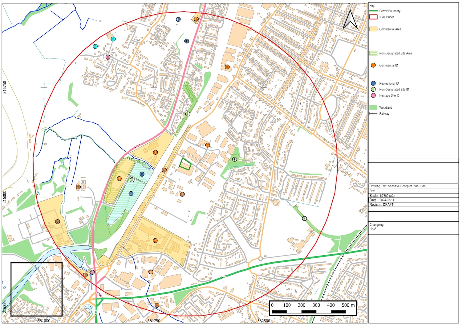
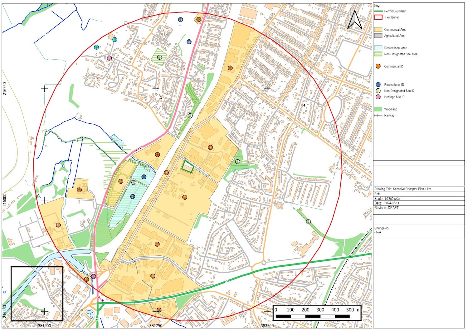
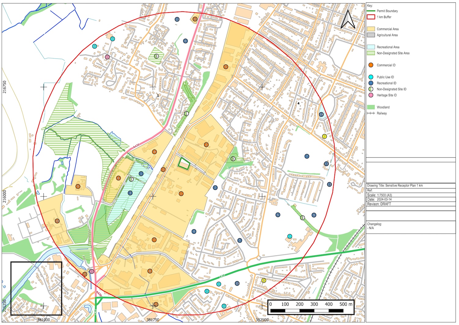
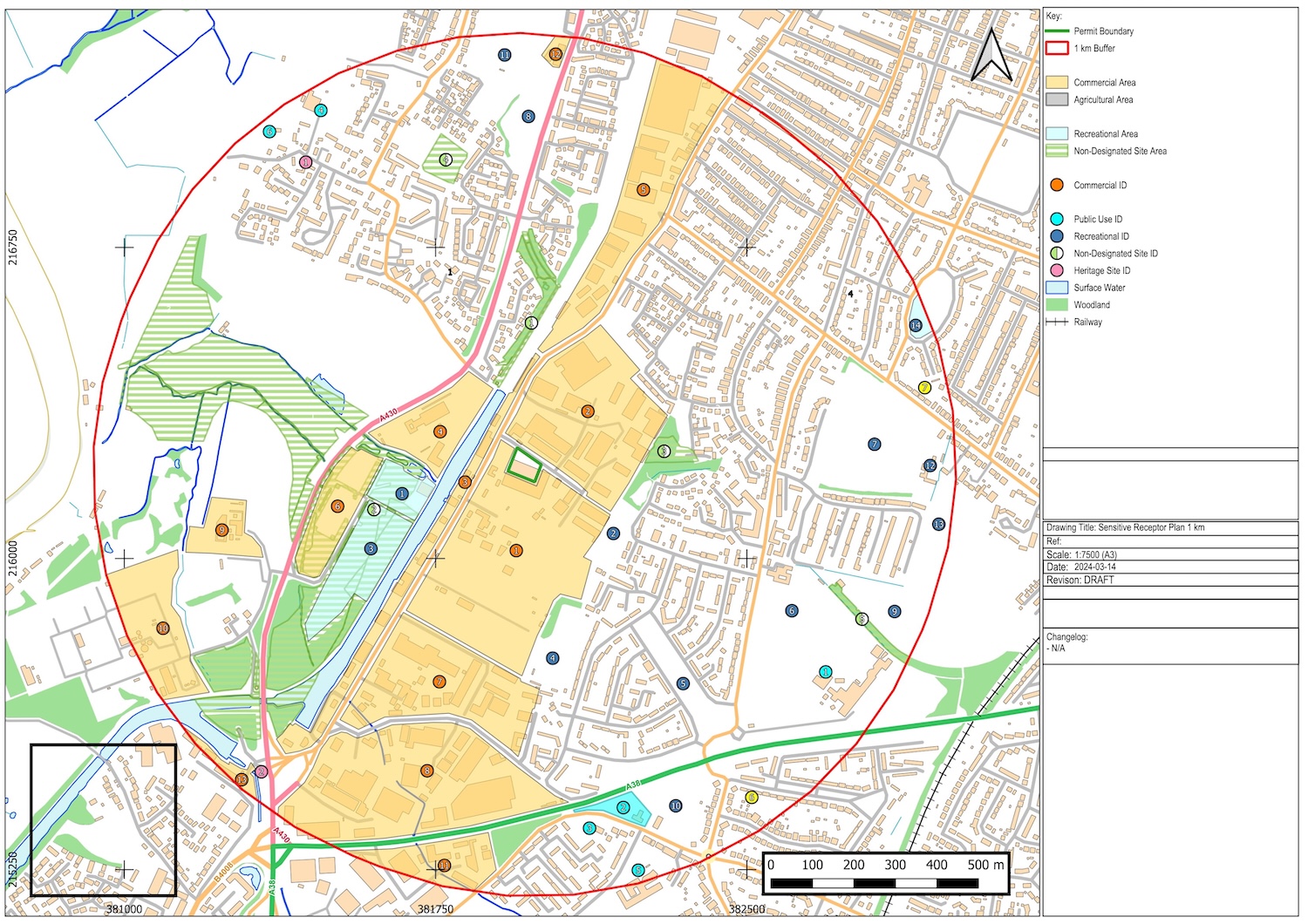
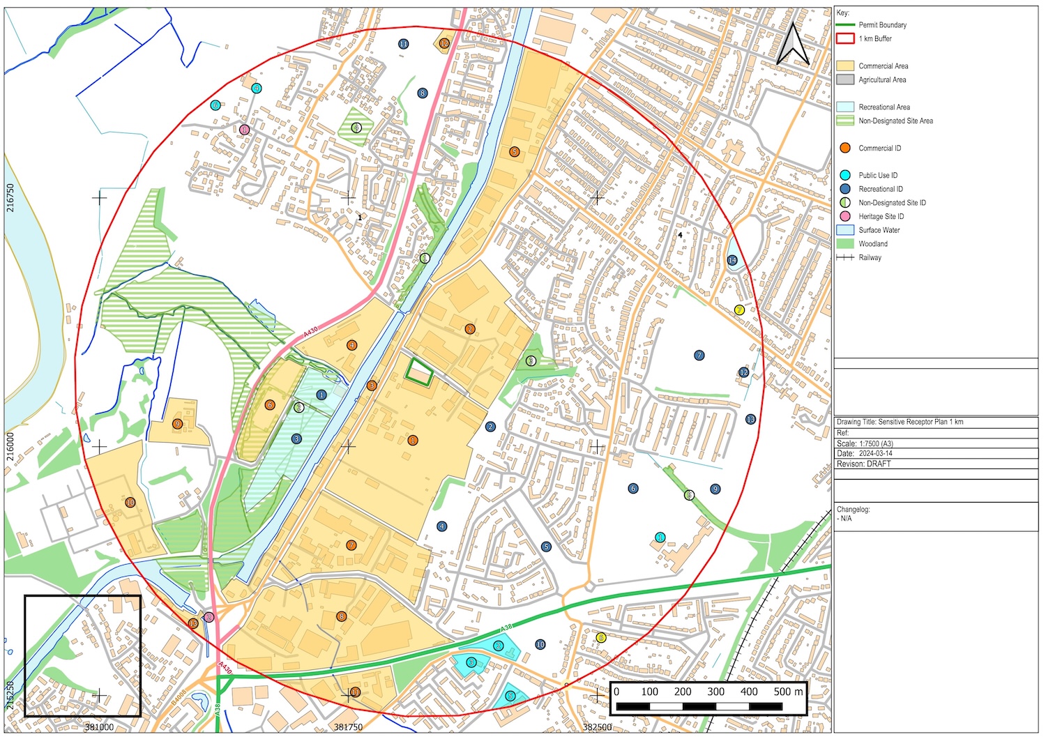
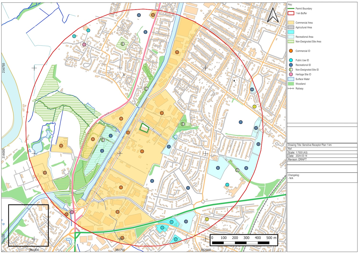
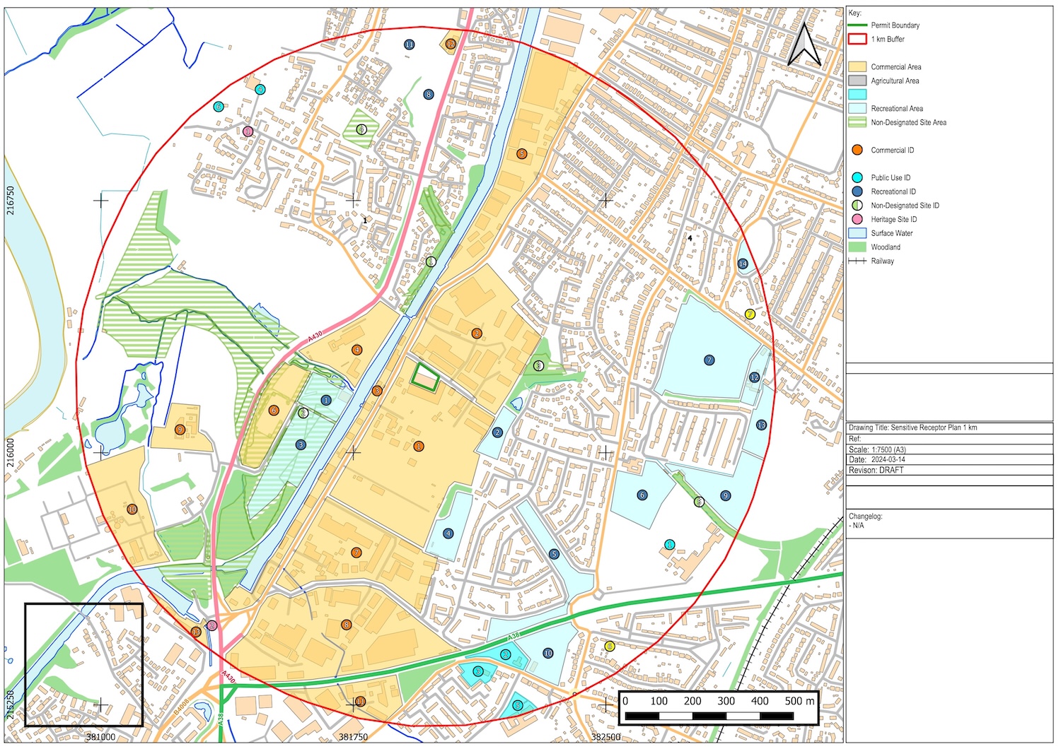
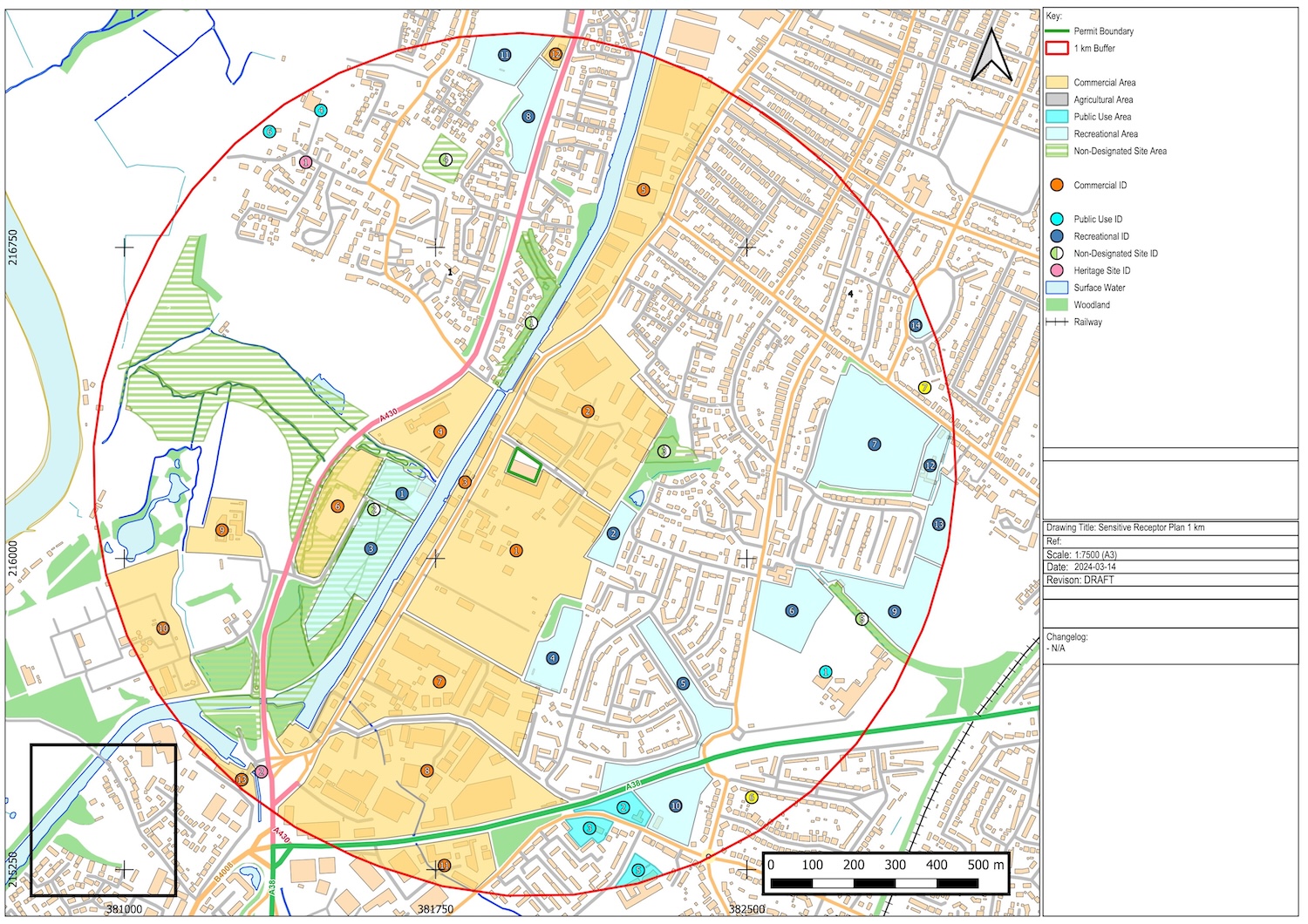
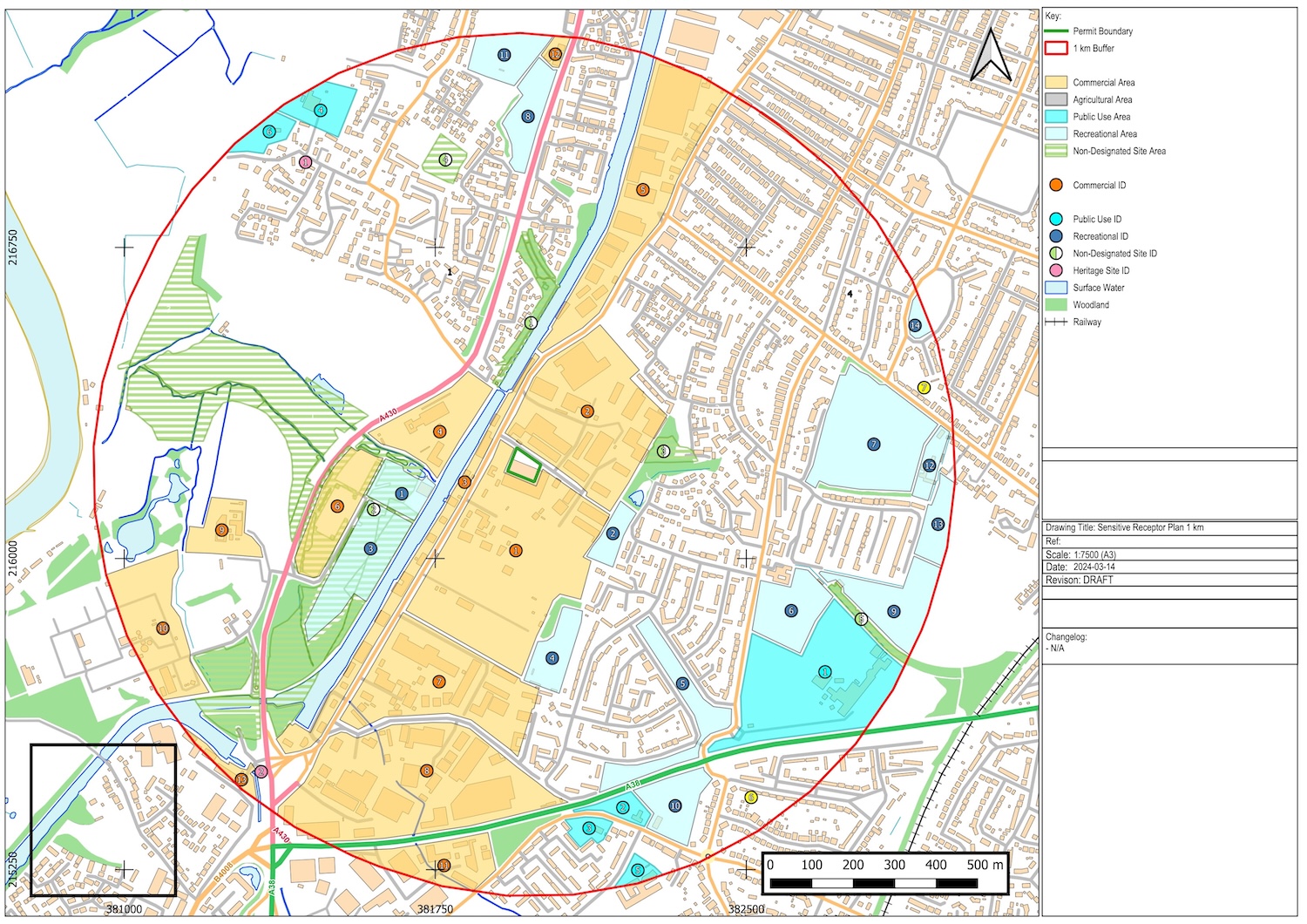
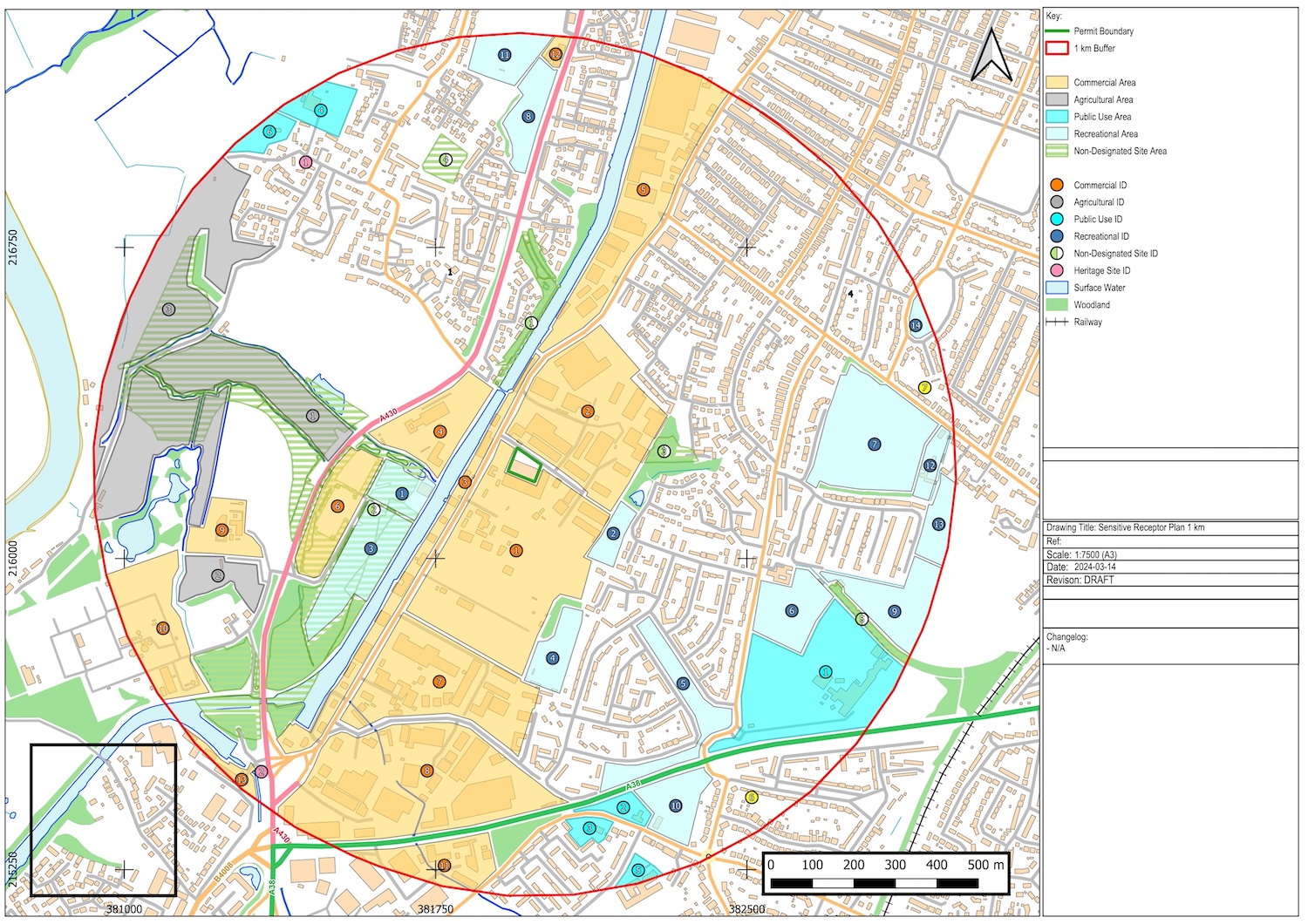
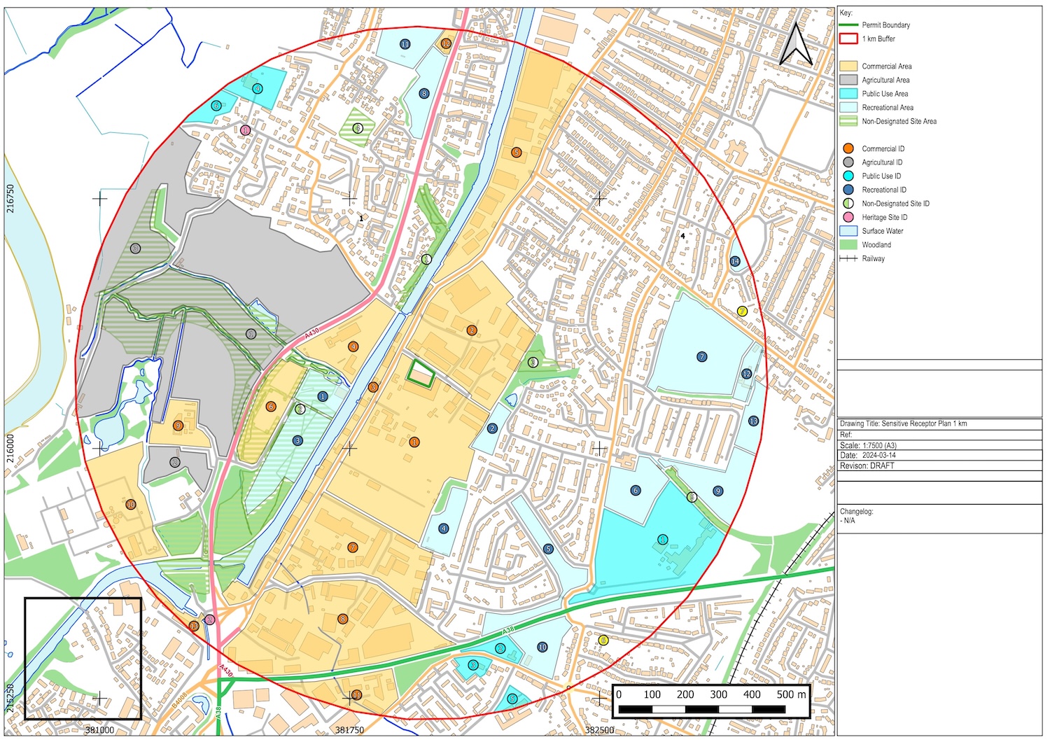
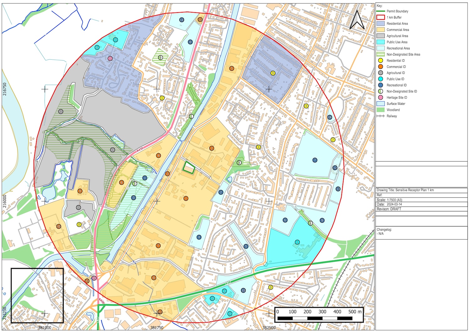
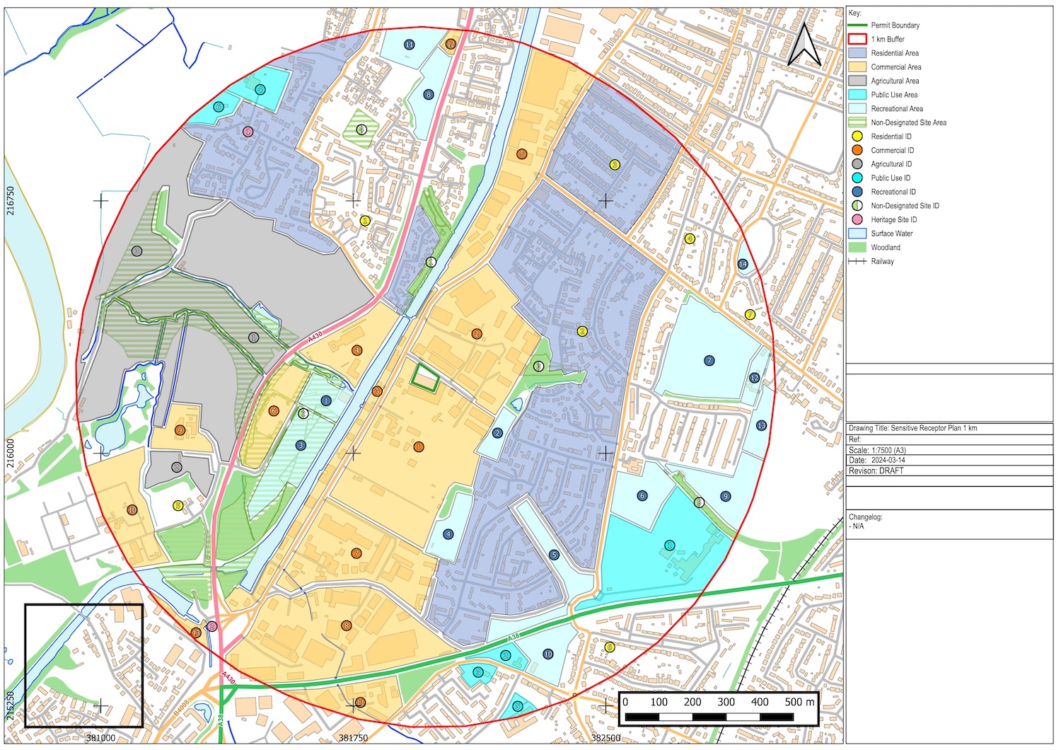
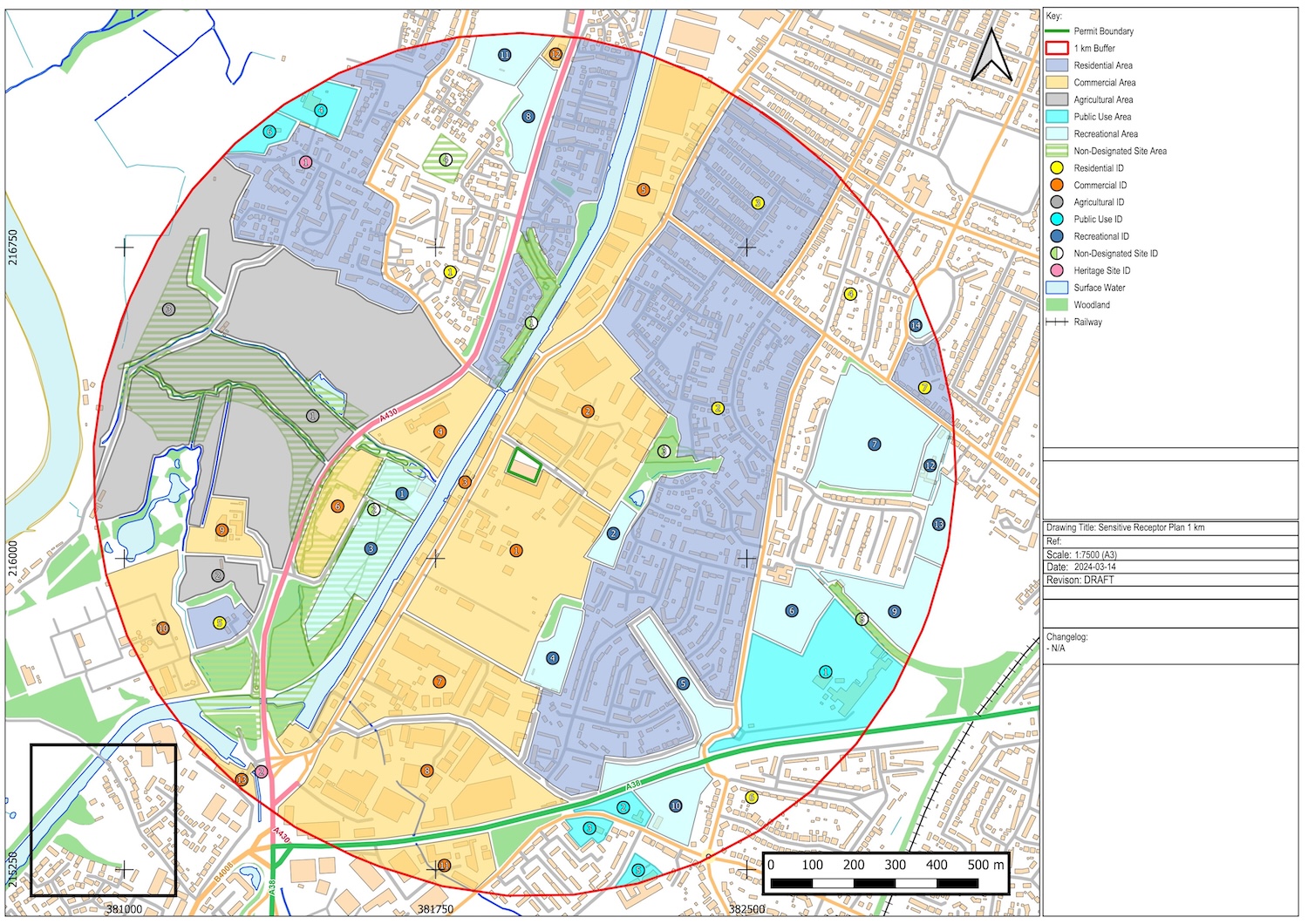
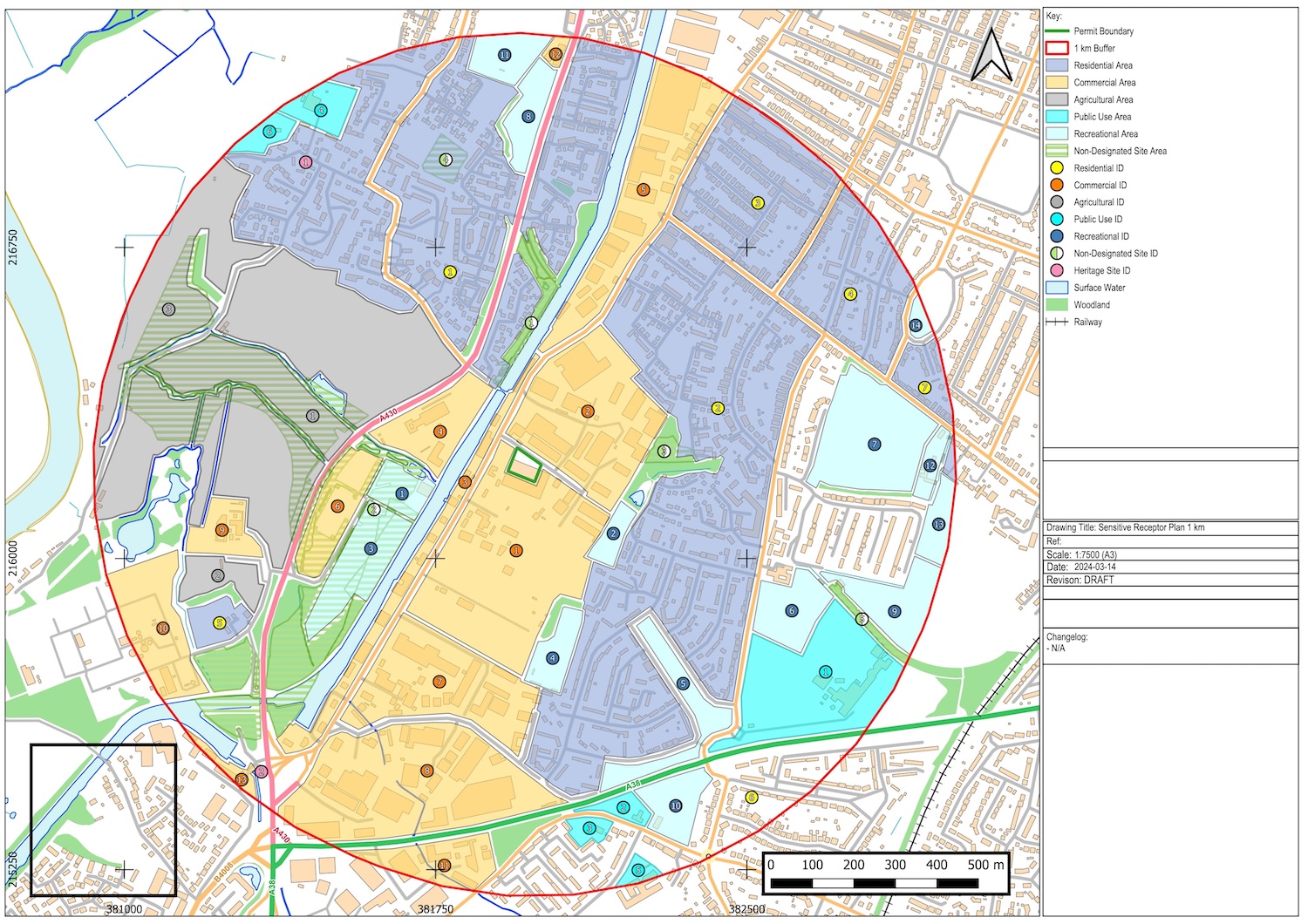
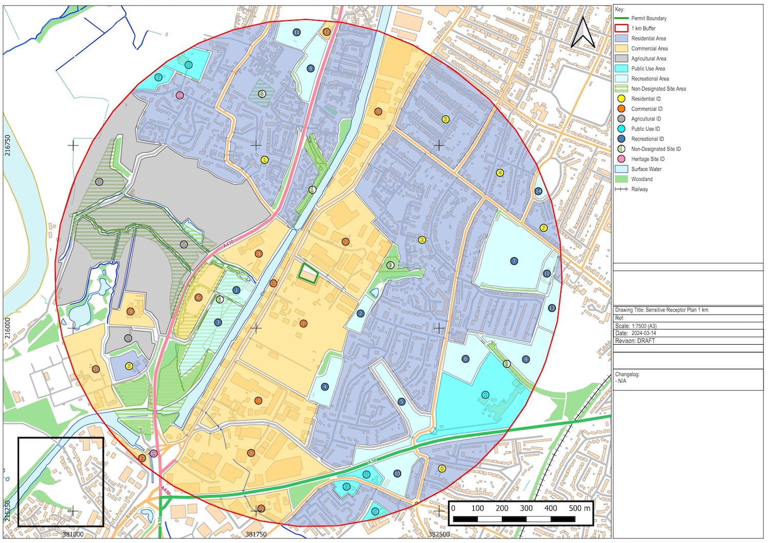
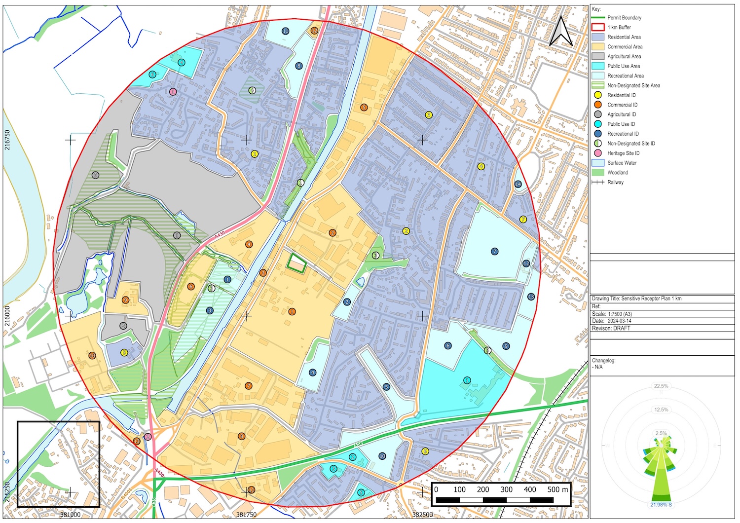
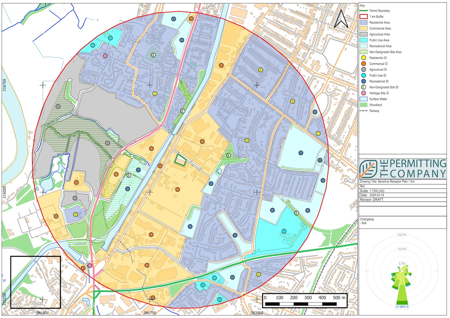
Sensitive Receptor Plans
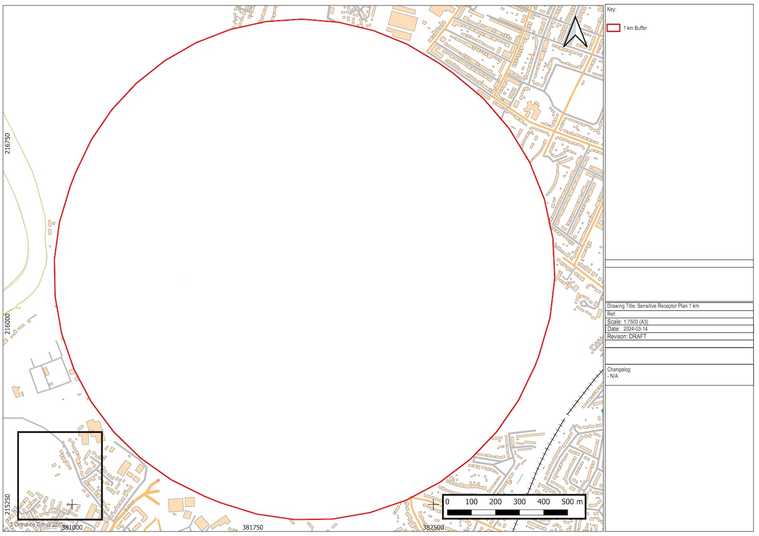
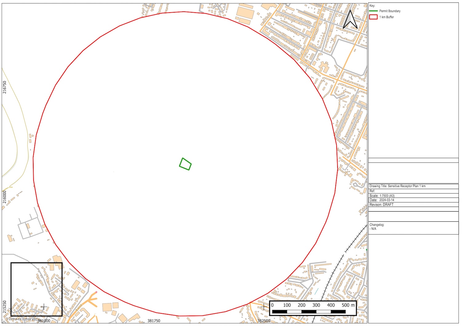
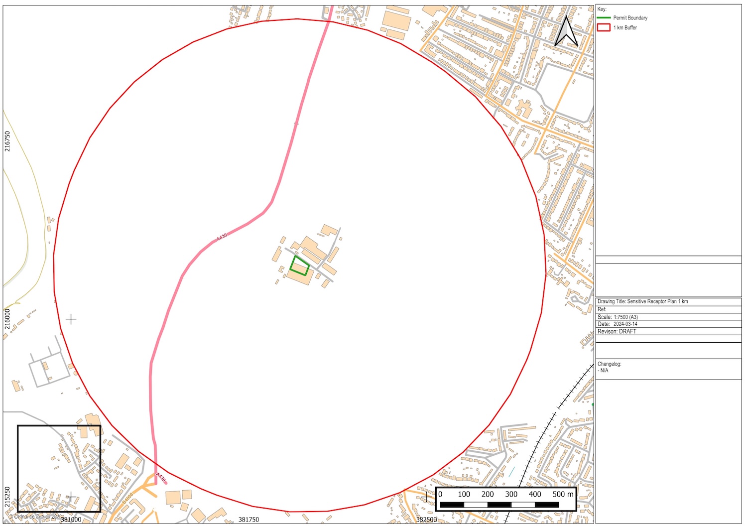
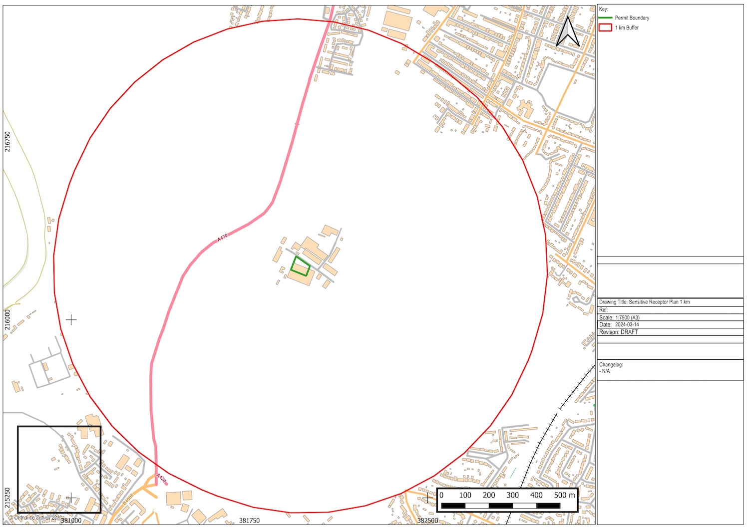
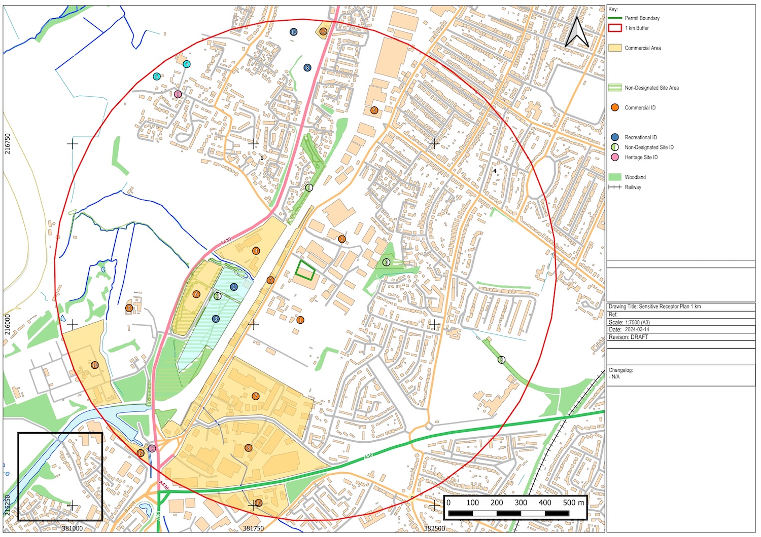
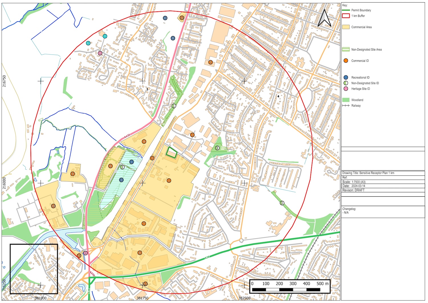
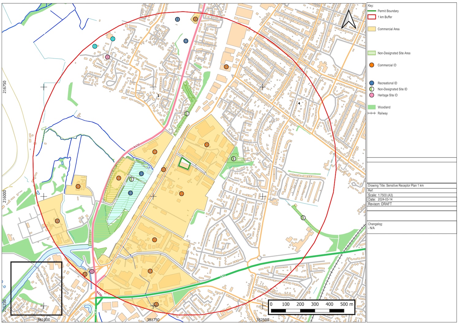
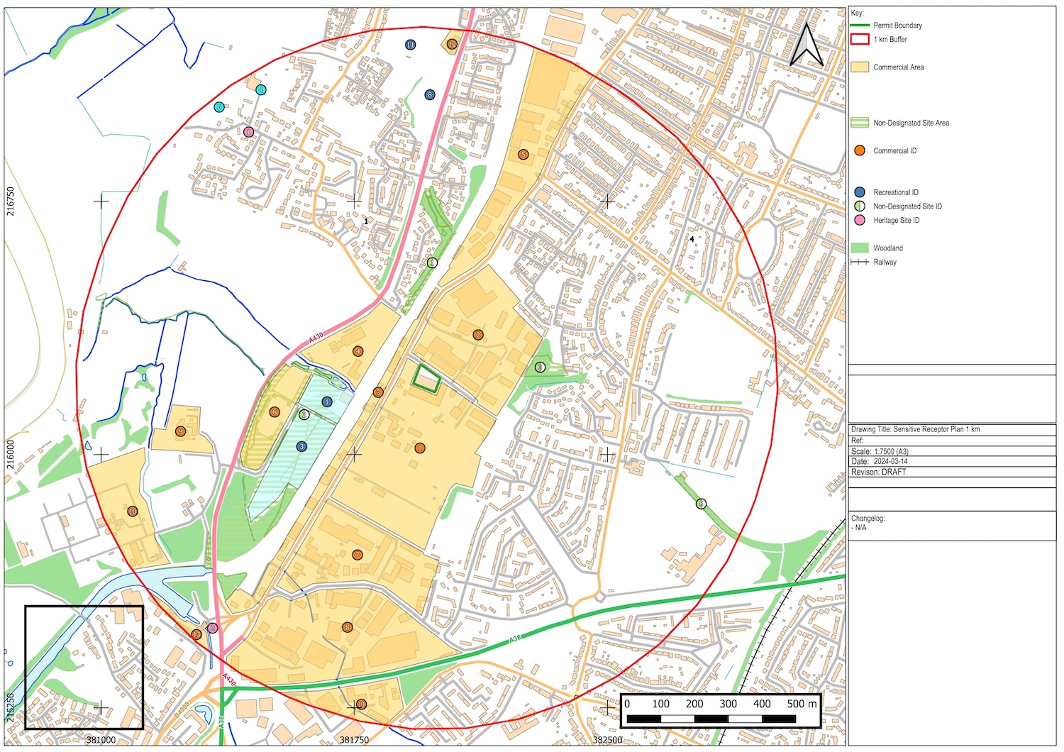
Sensitive receptor plans are radius buffers from the permitted site which are usually 1km, 2km, or 5km. The radius will depend on the type of permit you are applying for.
The purpose of the receptor plan is to identify sensitive locations that could be impacted by your operation.
The types of pollution that can escape your site and affect the sensitive receptors could be noise & vibration, odour, particulate matter, fumes, bioaerosols, pests/vermin, litter, mud/debris, discharge and run off.
Sensitive receptors can include:


The layout of buildings
Protected sites and species
Anywhere used to grow food or to farm animals or fish
Drain and sewer systems
Factories and other businesses
Fields and allotments used to grow food
Footpaths
Groundwater beneath your site
Homes, or groups of homes (such as villages or housing developments)
Private drinking water supplies
Schools, hospitals and other public buildings
Areas of scientific interest
Roads, railways, bus stations, pylons (on or immediately adjacent to the site only), utilities, airports
Playing fields and playgrounds
Regionally important geological sites
Water, EG. ponds, streams, rivers, lakes or the sea
Protected habitats, watercourses, groundwater, boreholes, wells and springs supplying water for human consumption
Compass rose showing north and the prevailing wind direction.
Knowing what sensitive receptors there are in proximity to your site will enable you to implement measures to ensure you are protecting the surrounding environment and complying with the conditions of your permit.
The Permitting Company Limited offer sensitive receptor plans as a standalone service (or in combination with other plans and maps if required).
This is to establish the sensitive receptors within a certain proximity from the site (usually a 1km radius).
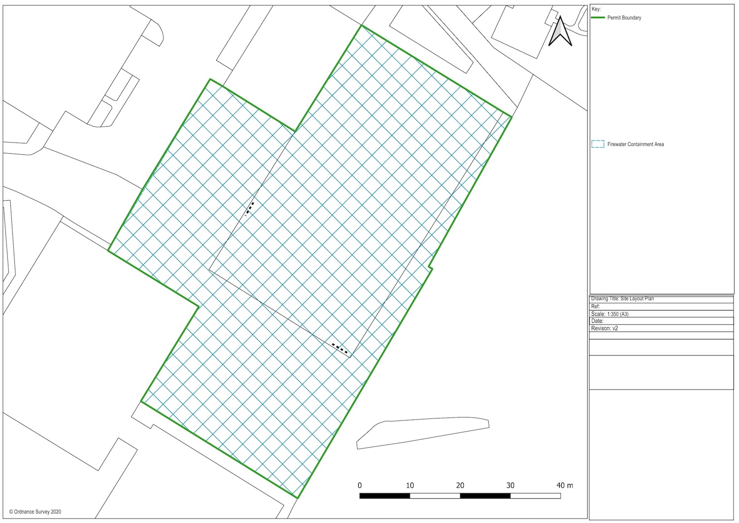
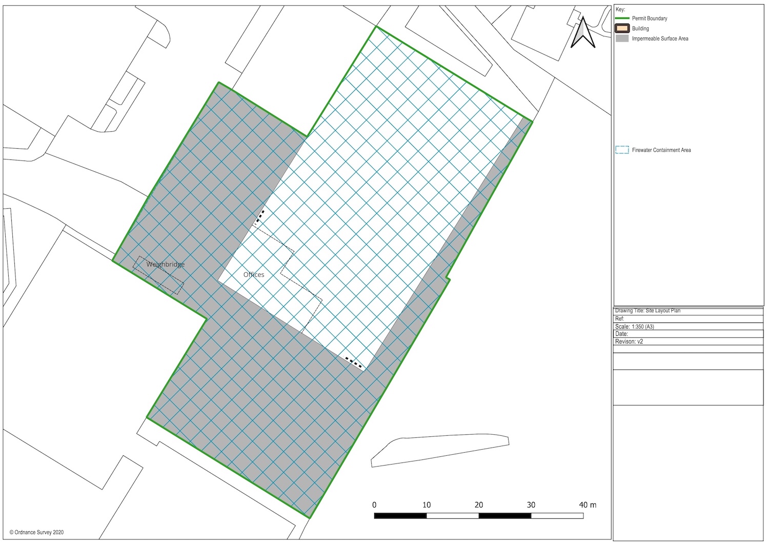
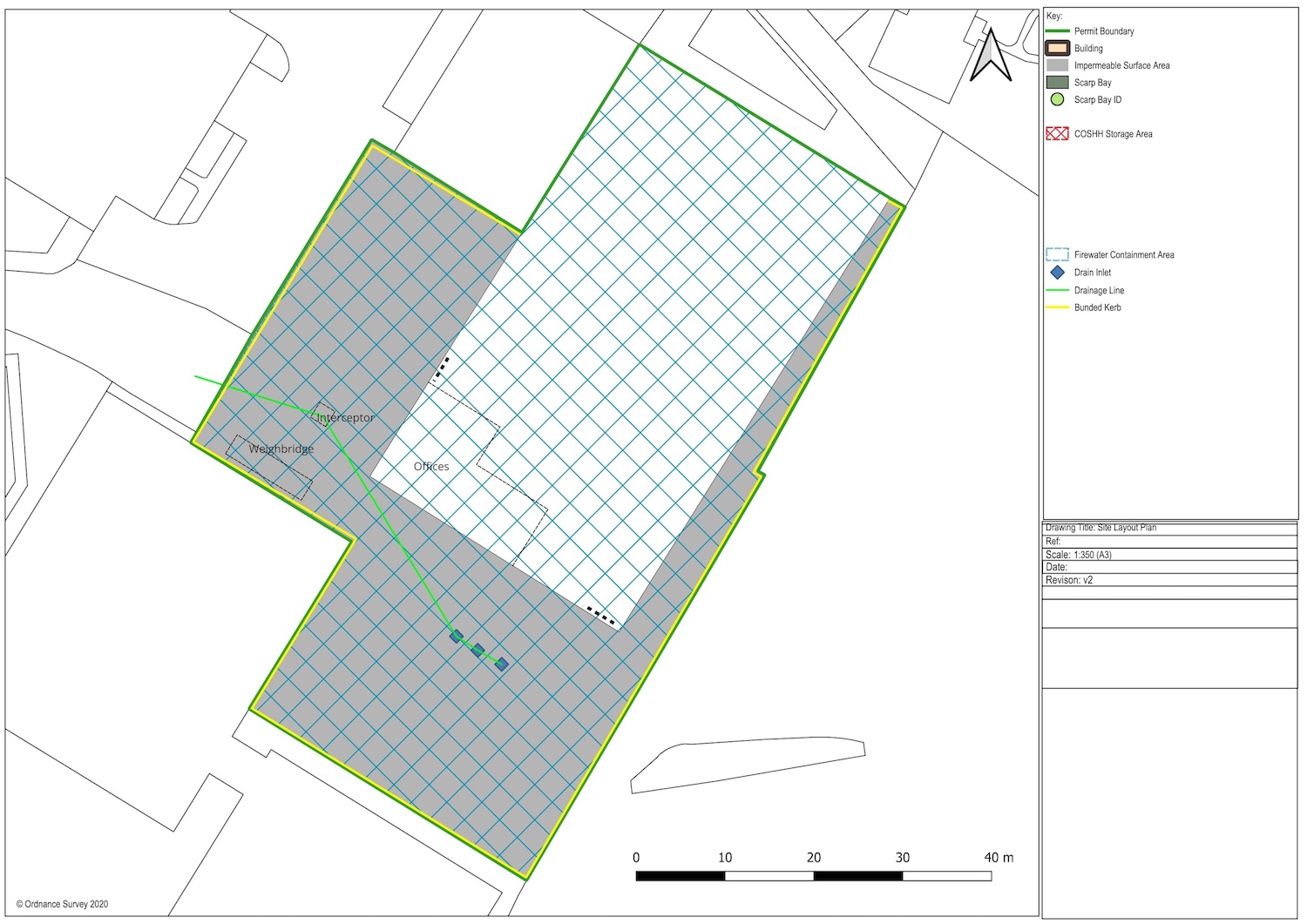
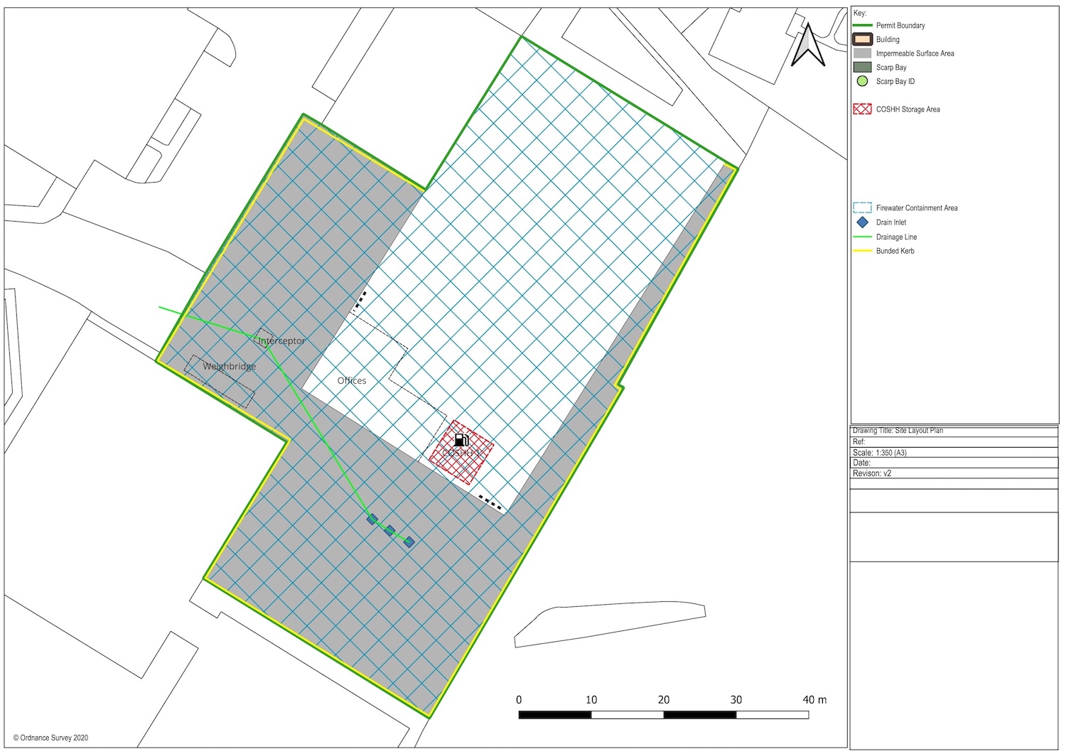
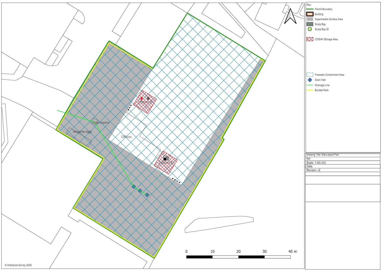
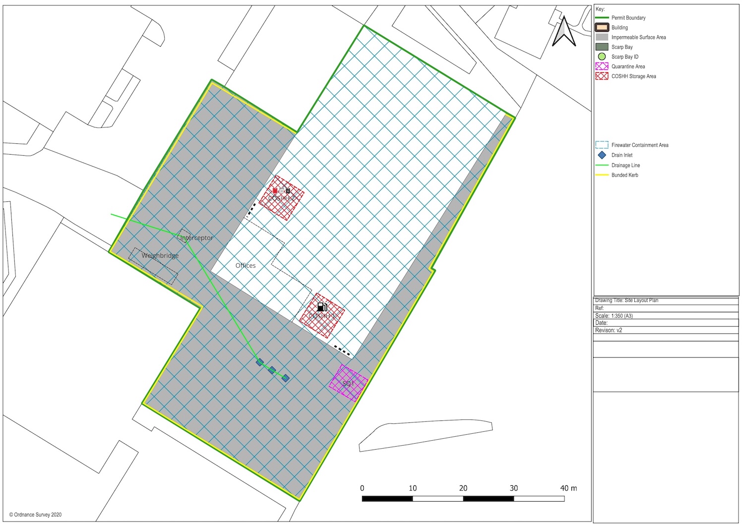
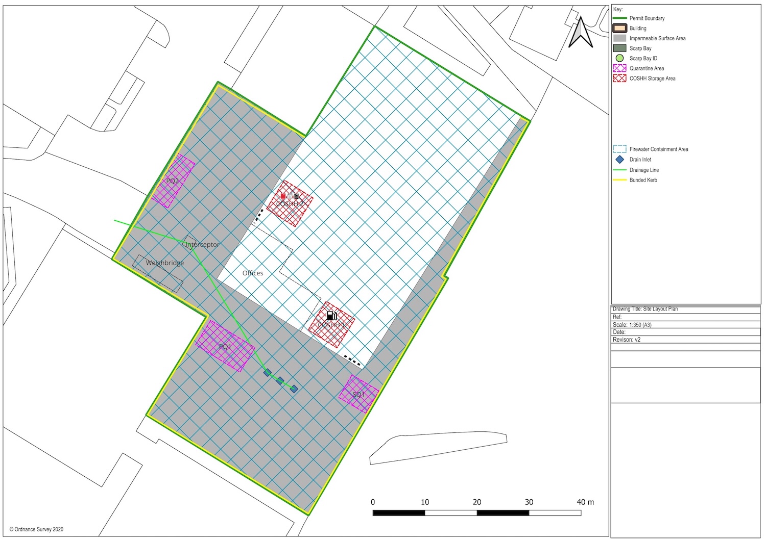
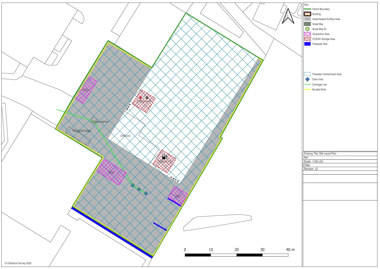
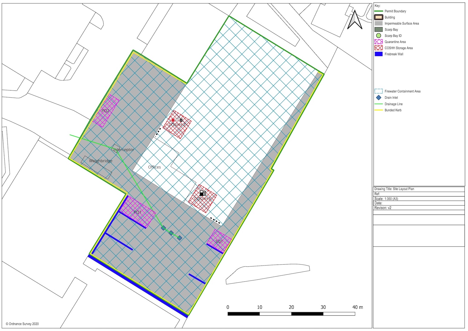
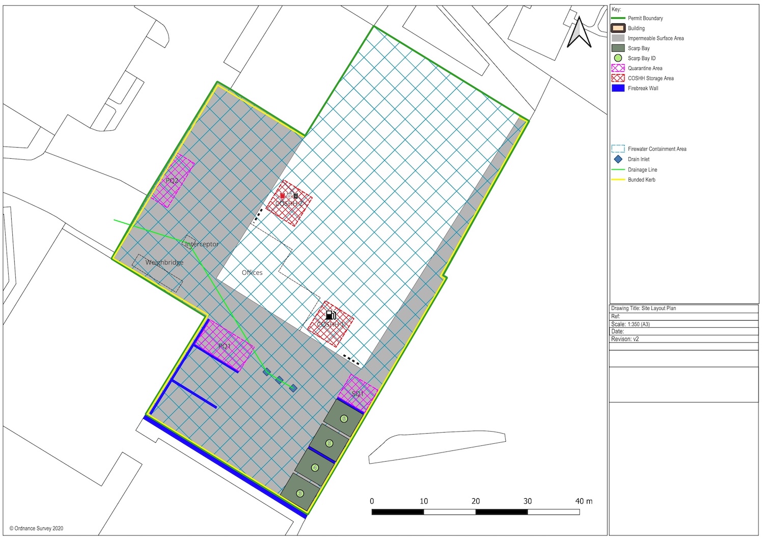
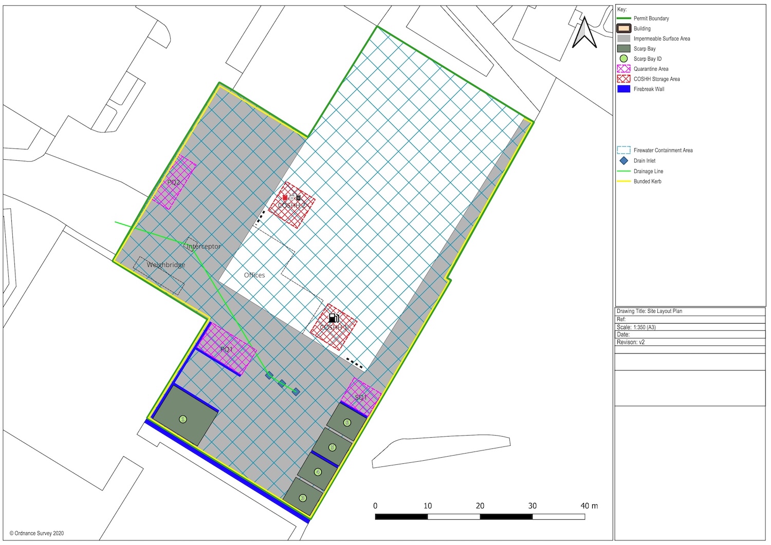
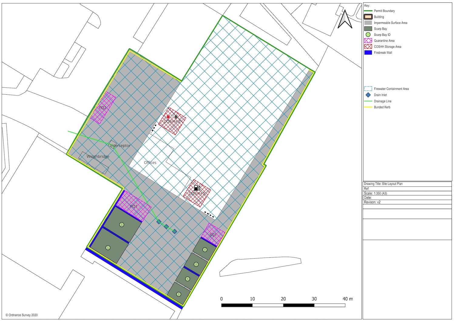
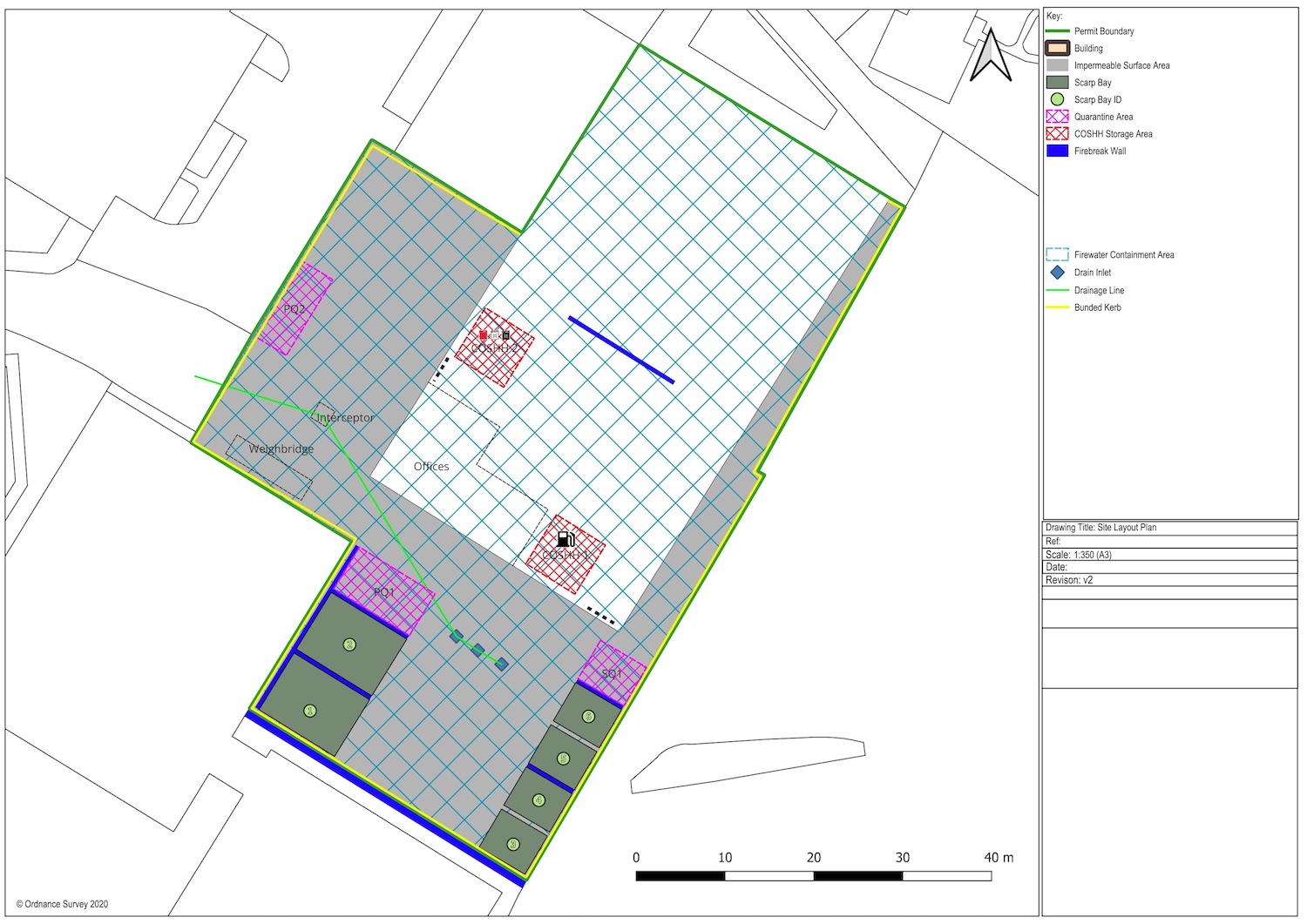
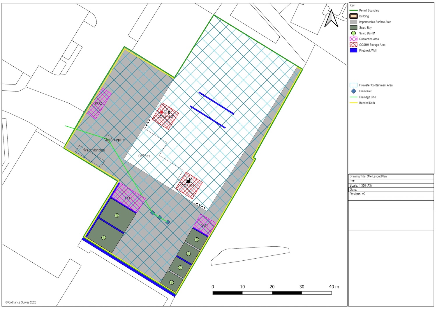
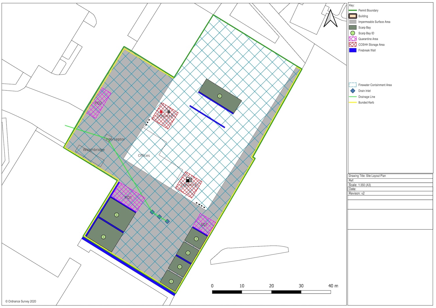
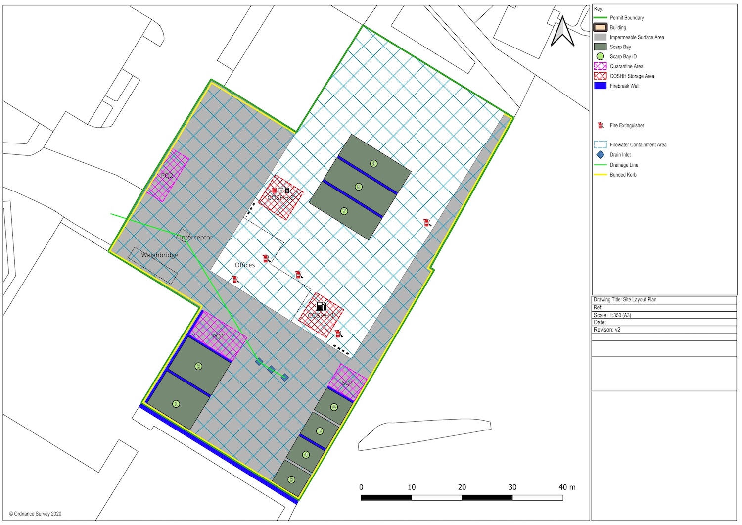
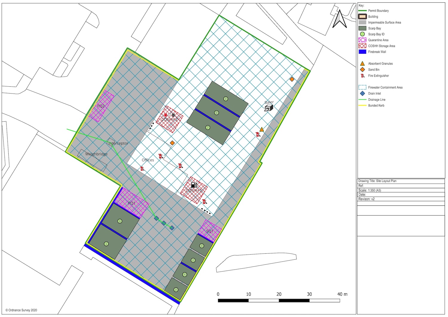
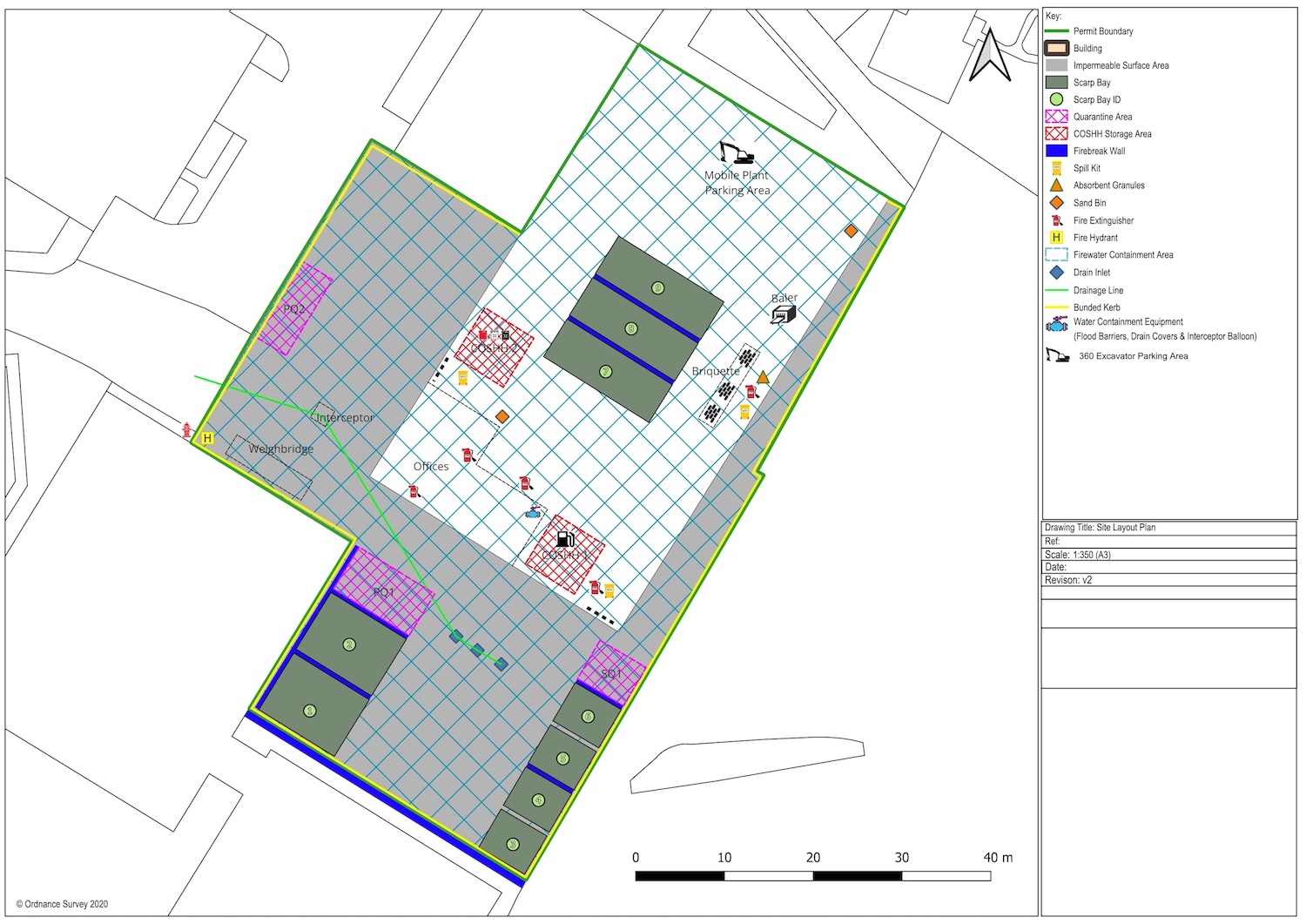
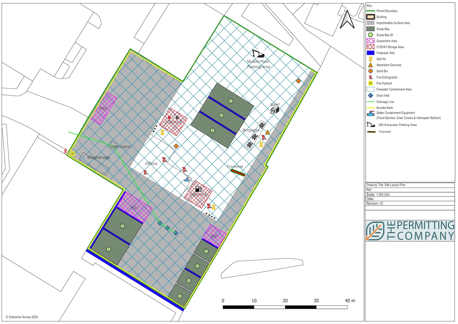
Site Infrastructure/Layout Plans
Site layout and infrastructure plans are required to demonstrate what protected features the site has within the permitted area.
This must be drawn to scale and include features such as:
Buildings, and other main constructions, like treatment plants, incinerators, storage silos and security fences
Storage facilities for hazardous materials like oil and fuel tanks, chemical stores, waste materials
Storage facilities for hazardous materials like oil and fuel tanks, chemical stores, waste materials
Location of items for use in accidents and emergencies, like absorbants for chemical spills
Entrances and exits that can be used by emergency services
Points designed to control pollution, for example inspection or monitoring points
Trade effluent or sewage effluent treatment plants
Effluent discharge points
Land that you believe is contaminated, for example areas of your site that have previously been used for industrial purposes
The location of discharge points to the sewer, watercourse or soakaway
The location of stop and diverter valves and interceptors
Gas and electric isolating valves and switches
All permanent ignition sources on your site and show they are a minimum of 6m away from combustible and flammable waste
All separation distances
Any area where crushing, shredding, baling, or other treatment of wase using fixed plant is occurring.
Access points around the site perimeter to assist firefighting
Hydrants and water supplies
Storage areas with pile dimensions and fire walls (where applicable) – this includes wastes stored in a building, bunker, or containers – include indicative pile layouts and ensure it is geographically representative
The location of fixed plant or where you store mobile plant when not in use


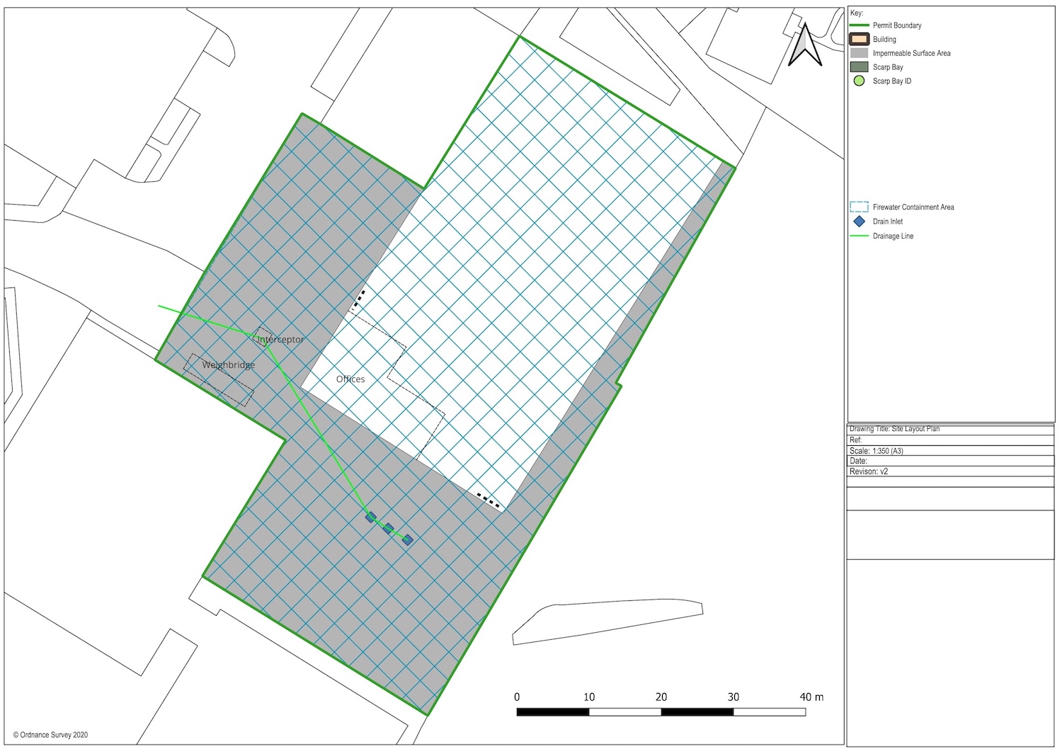


The direction of flow of the water in the drain
The location of manhole covers and drains
The mains water stop tap
The layout of buildings
Any areas where hazardous and flammable materials are stored on site (location of gas cylinders, process areas, chemicals, piles of combustible wastes, oil and fuel tanks)
Any areas where you are treating or storing combustible waste or combustible non-waste material
Any areas where you are storing combustible liquid wastes
Main access routes for fire engines and any alternative access
Areas of natural and unmade ground
Drainage runs, pollution control features such as drain closure valves, and fire water containment systems such as bunded or kerbed areas (this may be easier to show on a separate drainage plan)
The quarantine area
Anything site specific you consider needs to be added
In most instances, a layout plan will be required at the point of applying for an environmental permit, particularly if a fire prevention plan is required.
The layout plan should be revised throughout the lifetime of the site if anything changes e.g. dimensions of bays and changes in pollution prevention features such as drainage isolation valves.
The Permitting Company Limited offer site layout plans as a standalone service (or in combination with other plans and maps if required).
Our Services
The Permitting Company have a 100% success rate in getting Environmental Permits issued to operators. All we need is your time in explaining your proposed activity and we will take care of the rest.
There are different Competent Authorities which are responsible for regulating waste management facilities and issuing Environmental Permits. Depending on your location, following competent authority are:
Environment Agency (EA) England
Natural Resources Wales (NRW) Wales
Scottish Environment Protection Agency (SEPA) Scotland
The Permitting Company have worked with all the relevant Competent Authorities and understand the different application processes required to satisfy laws in each jurisdiction.